
« Cartographie du Lewsland » : différence entre les versions
Aucun résumé des modifications |
Aucun résumé des modifications |
||
| Ligne 4 : | Ligne 4 : | ||
|- | |- | ||
! colspan="2" align="center" valign="middle" height="40" style="font-weight: bold; font-size: 1em; background: #004040; color: #ffffff" | <font size="4">'''Cartographie du Lewsland'''</font size> | ! colspan="2" align="center" valign="middle" height="40" style="font-weight: bold; font-size: 1em; background: #004040; color: #ffffff" | <font size="4">'''Cartographie du Lewsland'''</font size> | ||
|- | |||
| colspan="2" style="text-align: center; padding-top: 0.7em; padding-bottom: 0.7em;" | [[Image:LCR-LW456789.png|200px]] | |||
|- | |- | ||
! colspan="2" align="center" valign="middle" height="20" style="font-weight: bold; font-size: 1em; background: #004040; color: #ffffff" | <font size="2">'''Informations Générales''' | ! colspan="2" align="center" valign="middle" height="20" style="font-weight: bold; font-size: 1em; background: #004040; color: #ffffff" | <font size="2">'''Informations Générales''' | ||
Version du 21 mai 2015 à 21:07
| Cartographie du Lewsland | |
|---|---|
| Informations Générales | |
| Etat | Lewsland, LWD, 01 |
| Type | Cartographie |
| Création | 2014 |
| Structure | |
| Fonctionnaires | 10 |
| Budget | 1 350 000 §imléons |
La Cartographie Lewslandaise est une institution lewslandaise assignée à l'établissement des cartes et des vues aériennes du Lewsland. Elle dépend de l'autorisation du Leader du Lewsland et de La Cartographie Régionale, géré par Technicolor YLI.
-

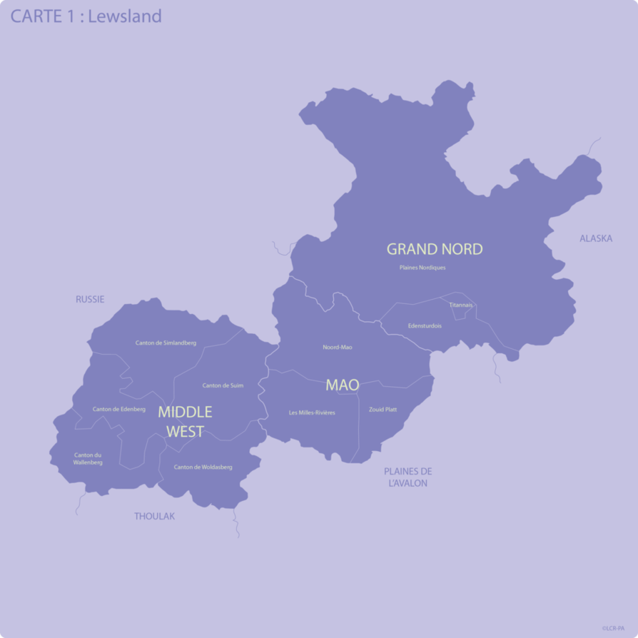
Subdivisions Administratives
-
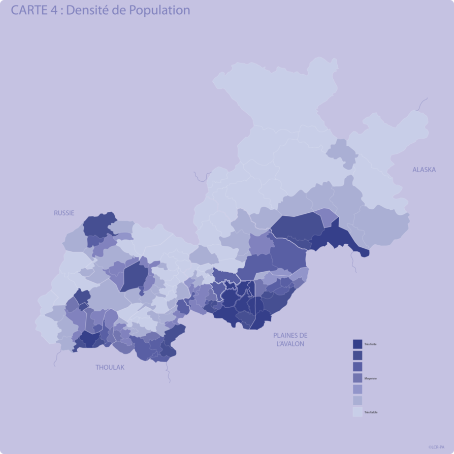
Densité de Population
-

Les Villes
-
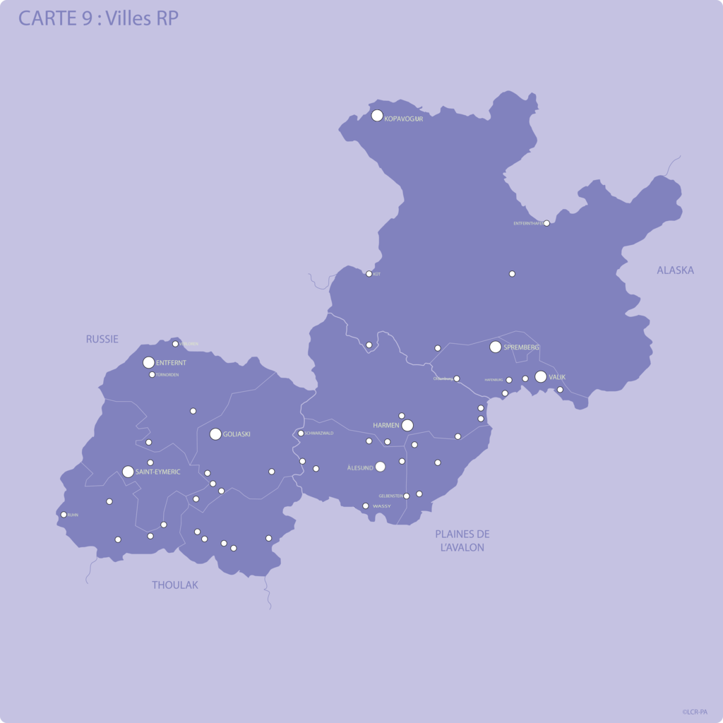
Ville Rp
-
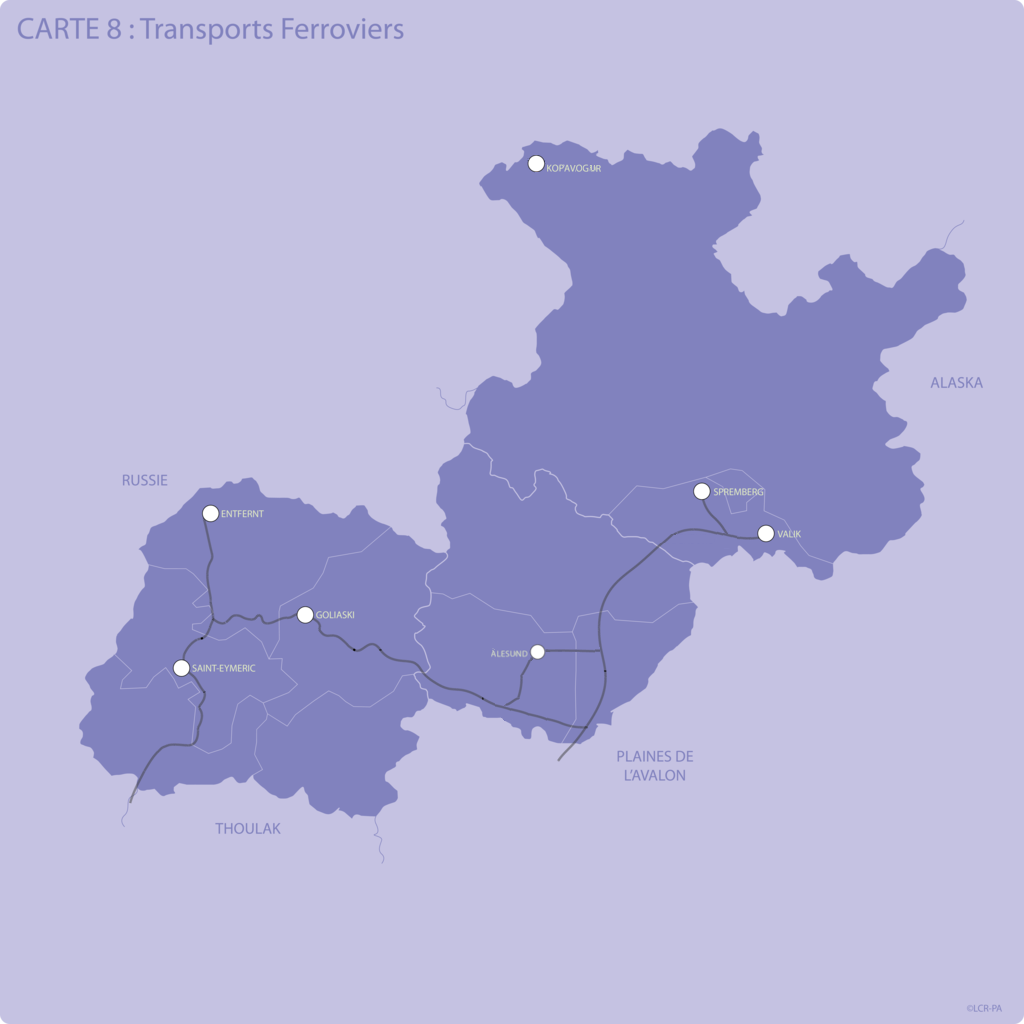
Transports Ferroviers
-
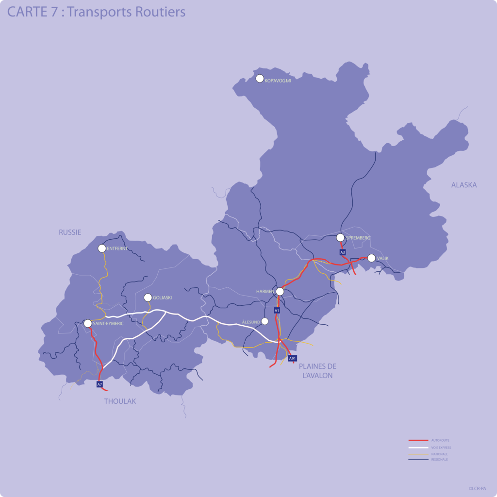
Transports Routiers
-
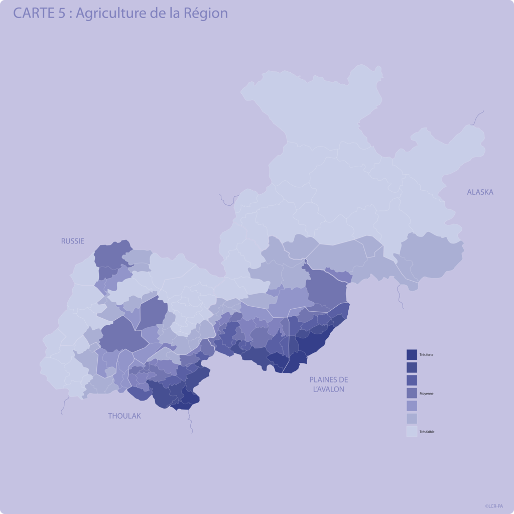
Agriculture de la Région
-

Langues
-
Lewsland


