
« Carthographie Thoulakienne » : différence entre les versions
Aucun résumé des modifications |
|||
| Ligne 29 : | Ligne 29 : | ||
==[[Image:Phrise thoulak.gif|center|100px]][[Fichier:Log Th.gif|45px]]Carte Géographique== | ==[[Image:Phrise thoulak.gif|center|100px]][[Fichier:Log Th.gif|45px]]Carte Géographique== | ||
==[[Image:Phrise thoulak.gif|center|100px]][[Fichier:Log Th.gif|45px]]Carte des Transports== | |||
==[[Image:Phrise thoulak.gif|center|100px]][[Fichier:Log Th.gif|45px]]Carte Economique== | ==[[Image:Phrise thoulak.gif|center|100px]][[Fichier:Log Th.gif|45px]]Carte Economique== | ||
Version du 30 juin 2013 à 13:01


La carthographie au Thoulak est chargé de l'etude et la confection de carte du Thoulak .

 Carte Administrative

-
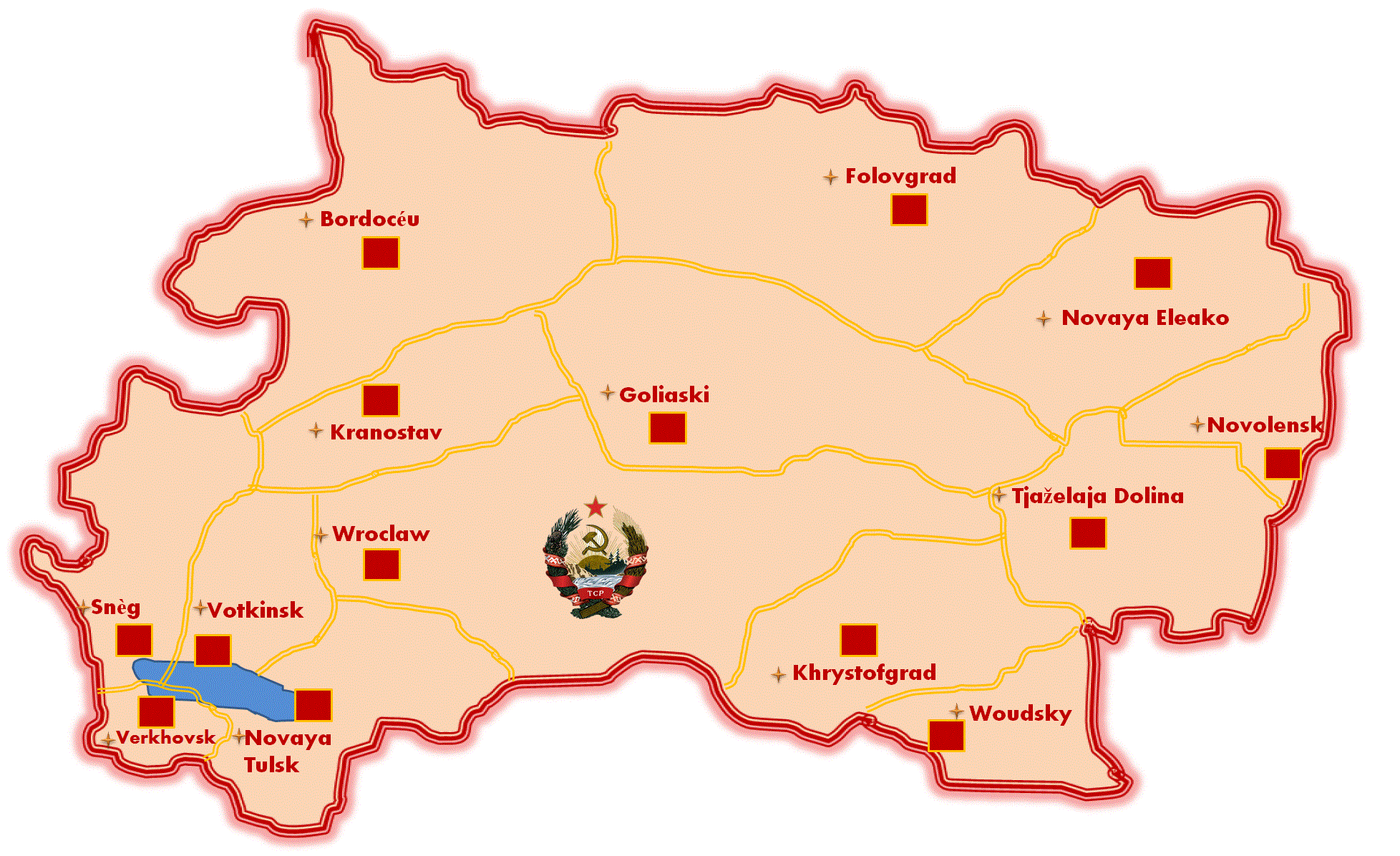
Carte des oblasts du Thoulak
-
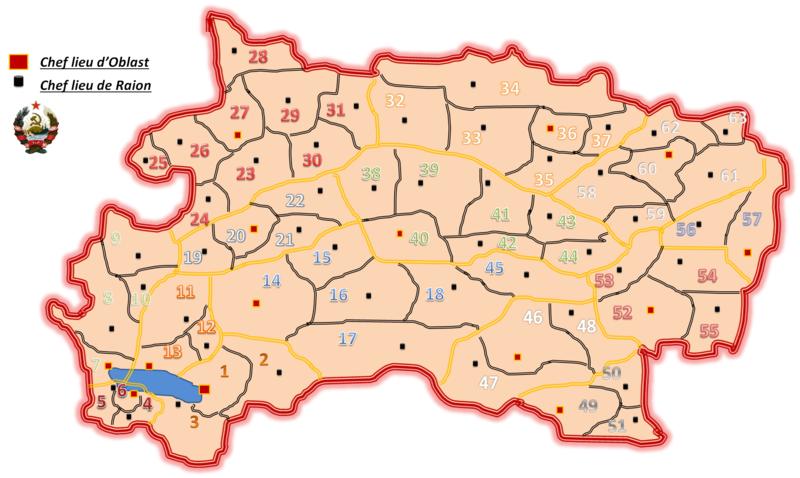
Carte des Raions du Thoulak


-

Carte repartition de la population

-

Carte Agricole du Thoulak
-
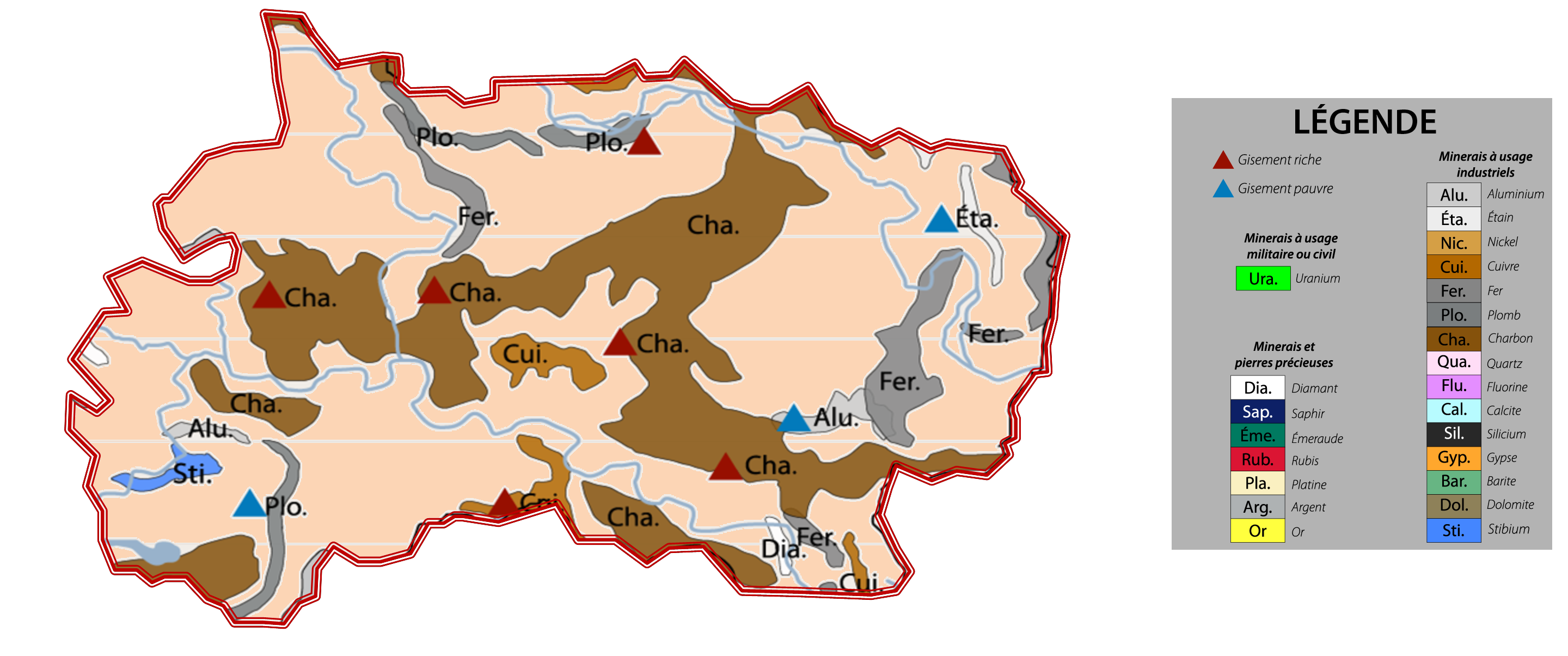
Carte Minerais du Thoulak

