« Kasteelheer » : différence entre les versions
Aucun résumé des modifications |
Aucun résumé des modifications |
||
| Ligne 1 : | Ligne 1 : | ||
{| class=" | {| class="toccolours" width="285" style="float:right;margin: 0em 0em 0em 1em;" | ||
|- | |- | ||
! colspan="2" align="center" valign="middle" height="40" style="font-weight: bold; font-size: 1em; background: #ddffdd; color: #000000" | <font size="3.5">'''Kasteelheer''' | |||
|- | |- | ||
| colspan="2" | | colspan="2" align="center" |[[Image:Kast.JPG|90px]] | ||
|- | |- | ||
| colspan="2" | | colspan="2" align="center" | <font size="1">Héraldique | ||
|- | |- | ||
! colspan="2" align="center" | ! colspan="2" align="center" valign="middle" height="12" style="font-weight: bold; font-size: 1em; background: #ddffdd; color: #000000" | <font size="2">'''Administration''' | ||
|- | |- | ||
| '''[[État]]''' || align="left" | [[Image:Drapeauhudson.jpg|20px]] [[Hudson-Rétanie]] | |||
|- | |- | ||
| '''[[Canton hudsonois|Canton]]''' || align="left" | [[Canton d'Oosterland]] | |||
| [[ | |||
| | |||
| [[ | |||
|- | |- | ||
| '''Communes limitrophes''' || align="left" | <font size="1"> Sint-Pieters-Kerk | |||
| | |||
|- | |- | ||
| '''[[Président]]''' || align="left" | [[Richard Piaget-Maurer]] | |||
|- | |- | ||
| '''NPA''' || align="left" | A définir | |||
| | |||
| | |||
| | |||
|- | |- | ||
! | ! colspan="2" align="center" valign="middle" height="20" style="font-weight: bold; font-size: 1em; background: #ddffdd; color: #000000" | <font size="2">'''Démographie''' | ||
| | |||
|- | |- | ||
| '''Gentilé''' || align="left" | Kastellois(es) | |||
|- | |- | ||
| '''Population''' || align="left" | 78 340 hab. <font size="1">(Juillet 2013) | |||
| | |||
|- | |- | ||
| '''Densité''' || align="left" | 1 069 hab./km² | |||
| | |||
| | |||
|- | |- | ||
! | ! colspan="2" align="center" valign="middle" height="20" style="font-weight: bold; font-size: 1em; background: #ddffdd; color: #000000" | <font size="2">'''Géographie''' | ||
|- | |- | ||
| '''Altitude''' || align="left" | 410 m | |||
| | |||
|- | |- | ||
| '''Superficie''' || align="left" | 7 322 ha = 73.22 km² | |||
| | |||
|- | |- | ||
! | ! colspan="2" align="center" valign="middle" height="20" style="font-weight: bold; font-size: 1em; background: #ddffdd; color: #000000" | <font size="2">'''Divers'''</font size> | ||
| | |||
|- | |- | ||
| '''Langue'''||align="left" | <span style="margin:0px; font-size:90%;"> Flamand occidental</span> | |||
| | |||
|- | |- | ||
|<font color=#000000>''' '''</font color> || align="left" | <span style="margin:0px; font-size:90%;"> Néerlandais (officielle)</span> <br> | |||
| | |||
|- | |- | ||
! | ! colspan="2" align="center" valign="middle" height="20" style="font-weight: bold; font-size: 1em; background: #ddffdd; color: #000000" | <font size="2">'''Localisation'''</font size> | ||
| 2 | |||
|- | |- | ||
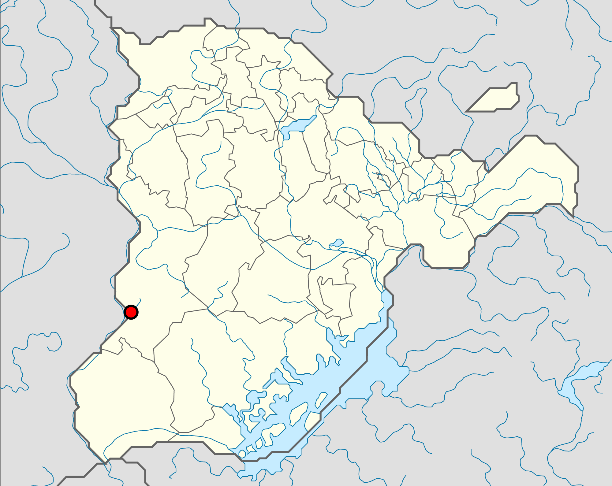
| colspan="2" align="center" | <font size="1">Localisation de Kasteelheer sur la carte | |||
| | |||
|- | |- | ||
! [[Image: | ! colspan="2" align="center" |[[Image:Localisation-Kasteelheer.png|285px]] | ||
|- | |- | ||
! colspan="2" align="center" valign="middle" height="20" style="font-weight: bold; font-size: 1em; background: #ddffdd; color: #000000" | <font size="2">'''Liens'''</font size> | |||
|- | |- | ||
| colspan="2" align="center" | [http://www.simland.eu/forum/hudson/kastelheer-enclave-hudsonoise-aux-t13985.html Sujet de la ville] | |||
|} | |} | ||
Version du 1 octobre 2013 à 21:58
| Kasteelheer | |
|---|---|

| |
| Héraldique | |
| Administration | |
| État | |
| Canton | Canton d'Oosterland |
| Communes limitrophes | Sint-Pieters-Kerk |
| Président | Richard Piaget-Maurer |
| NPA | A définir |
| Démographie | |
| Gentilé | Kastellois(es) |
| Population | 78 340 hab. (Juillet 2013) |
| Densité | 1 069 hab./km² |
| Géographie | |
| Altitude | 410 m |
| Superficie | 7 322 ha = 73.22 km² |
| Divers | |
| Langue | Flamand occidental |
| Néerlandais (officielle) | |
| Localisation | |
| Localisation de Kasteelheer sur la carte | |

| |
| Liens | |
| Sujet de la ville | |
Kasteelheer (en patois local Kastel, et Kastelheer en Symlandertüütsch) est une ville de l' État hudsonois. C’est une ville située à l'extrême Ouest de l'Hudson, à 7km de la frontière avec les Plaines de l'Avalon . Ses habitants sont appelés les Kastellois. La ville est surtout connue pour son château perché sur la colline Kruisdonk .
La ville est le chef-lieu du canton d'Oosterland.
Au 20 février 2012, elle comptait 47.186 habitants.
Toponymie
Le nom de Kasteelheer viens du néerlandais kasteel (le château) et de heer (le seigneur). Le nom de la ville signifie Seigneur du château. Les historiens s'accordent sur le fait que la ville a été baptisée de ce nom en l'honneur du seigneur Knut II.
Héraldique
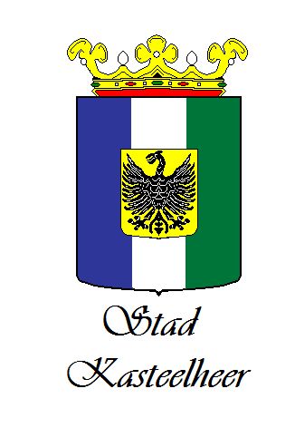
Le blason de la ville est formé de trois bandes , l'une bleue représentant le lac, le blanc la toge des moines qui on bâtis les premières habitations de la ville et le vert qui représente les forêts environnantes. Il y a une controverse sur le blason, en effet, selon l'histoire de la ville, l'aigle houdois est représenté en écu sur le blason. Cette version est parfois remise en cause par une partie des habitants.
Histoire
Le site de Kasteelheer est occupé dès la préhistoire. Des fouilles archéologiques ont mis au jour des monnaies et les restes d'un ancien cimetière, ce qui permet d'affirmer une présence humaine dans les premiers siècles de notre ère.
La ville est mentionnée pour la première fois en 872 sous le nom de "Kaasteel", son territoire est alors occupé par les moines de Sint-Pieters-Kerk.
Le 16 juin 1106, le seigneur Knut II, roi de Houde achète Kasteel et la rebaptise en Kasteelheer et toutes ses dépendances aux ecclésiastiques locaux . Kasteelheer devient ainsi une des 6 Bonnes Villes de Houde de la seigneurie de Knut II.
Elle devient alors également capitale de sa châtellenie regroupant la commune actuelle et Sint-Pieters-Kerk. La châtellenie délimite le territoire à l'extrême Ouest de l'Hudson. La charge de châtelain revient au seigneur de Kasteelheer jusqu'en 1565, année durant laquelle le prince Bernt Ier prends le pouvoir sur la cité.
Aux XIIIe et XIVe siècles, Kasteelheer participe activement aux luttes sociales qui agitent le royaume de Houde, ce qui lui vaudra d'être incendiée en 1608 lors de la révolte des villes contre l'évêque Jean XXIII.
En 1654, la ville est assaillie et brûlée une nouvelle fois puis occupée durant cinq ans par les troupes du roi de France. Au XVIIe siècle, la ville étant située sur le lieu de passage, elle souffrira notamment des ravages causés par des mercenaires . La ville fut de nombreuses fois prise par divers pays. En 1673, elle est de nouveau occupée par les Français qui démantèlent le château fort. Ils l'occupent encore en 1696, 1707, 1711 et 1747.
En 1831, suite à un conflit entre la Houde et les Uluriens, soutenus par les anglais, la ville est annexée par l'Uluru.
Historiquement, la ville fait partie de la Houde. La ville a toujours fait partie de l'espace linguistique néerlandophone à l'instar du canton de Oosterland. Le canton d'Oosterland a été créé en 2012.
Géographie
La plus grande partie de la ville est encaissée dans la vallée de l'Oos, au bord du lac éponyme formé par une petite rivière affluente de l'Hudson (l'Oos). La ville s'est constituée par extensions successives de quartiers situés toujours plus à l'Est, où se trouvent concentrées la plupart des activités industrielles.
En dépit de l'urbanisation progressive du centre ville, l'essentiel du tissu urbain se trouve concentré en une longue bande d'une dizaine de kilomètres de long, située au bord du lac.
Climat
La ville bénéficie d’un climat semi-continental (été chaud à orages fréquents, hiver relativement froid, fortes amplitudes thermiques suivant les saisons) mais relativement doux et ensoleillé en comparaison de certaines autres régions. Sur une année, la différence de température est surtout sensible l’été, où la région de Kasteelheer est souvent l’une des plus chaudes de l'état.
| Mois | Jan | Fév | Mars | Avr | Mai | Juin | Juil | Août | Sept | Oct | Nov | Déc | Année |
|---|---|---|---|---|---|---|---|---|---|---|---|---|---|
| Température maximale moyenne (°C) | 5,1 | 6,8 | 11,3 | 15,0 | 19,8 | 22,7 | 25,3 | 25,2 | 21,0 | 15,1 | 9,1 | 6,3 | 15,3 |
| Température minimale moyenne (°C) | -1 | 0.5 | 3,6 | 5,9 | 10,3 | 13,2 | 15,5 | 15,4 | 12 | 7,9 | 3,4 | 1,1 | 7,4 |
| Précipitations (mm) | 53,1 | 54 | 58,3 | 73,7 | 102,8 | 109 | 99,2 | 84 | 75,9 | 75,3 | 70,8 | 73,6 | 929,7 |
