« Pic Simmania » : différence entre les versions
| Ligne 39 : | Ligne 39 : | ||
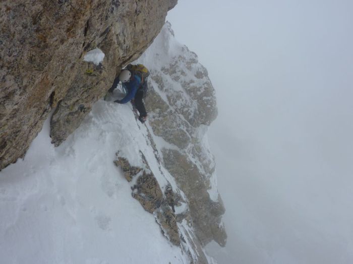
[[Fichier:Pic Simmania hivernale.jpg|thumb|left|Ascension en hiver du Pic Simmania|300px]] | [[Fichier:Pic Simmania hivernale.jpg|thumb|left|Ascension en hiver du Pic Simmania|300px]] | ||
{| class="wikitable" | |||
! Voie | |||
! Distance | |||
! Pente maximale | |||
! Pente moyenne | |||
! Profil | |||
|- | |||
| I | |||
| ~7 km | |||
| + 86 % / - 87 % | |||
| + 27 % / - 15 % | |||
| | |||
|- | |||
| II | |||
| | |||
| | |||
| | |||
| | |||
|- | |||
| III | |||
| | |||
| | |||
| | |||
| | |||
|- | |||
| IV | |||
| | |||
| | |||
| | |||
| | |||
|} | |||
{{Modèle:Géographie}} | {{Modèle:Géographie}} | ||
[[Catégorie:Nature]] | [[Catégorie:Nature]] | ||
Version du 14 juillet 2018 à 18:42
| Pic Simmania | |
|---|---|
 
| |
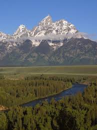
| Le Pic Simmania vu de la vallée du fleuve Hanovria | |
| Pays | Simland |
| Région | Thoulak |
| Etat | ... |
| Massif | Montagnes Rocheuses |
| Altitude | 2765 m |
Le Pic Simmania est un sommet des Montagnes Rocheuses, situé dans le sud-est du Thoulak. Il culmine à 2765 mètres d'altitude.
Ascension
 Article détaillé : Alpinisme à Simland
Premières ascensions
Connu par les premières populations de la région, la première ascension du Pic Simmania n'est pas recensée. La première ascension prouvée remonte à celle des Russes Cornelius Mirko et Zahar Isayev, en 1821. Ils ont effectué l’ascension du 4 avril à 10h00 au 7 avril à 18h00 (date d'arrivée). L'ascension du pic a durée 19 heures. Relativement clémente, la météo a été en leur faveur avec une température au sol de 2,8 °C et au sommet de -5,6 °C (d'après leurs relevés).
Une première tentative d’hivernale est lancé début janvier 1823 par un groupe de Russes. Cependant, ils ne parviennent qu'à une hauteur de 1860 m et sont obligés de redescendre après deux jours d'excursion. La première hivernale réussie est effectuée trois ans plus tard, en 1826, par les Russes Cornelius Mirko, Zahar Isayev, Robert Borodin et Jaroslav Pirogov. L'équipe s'élance le 10 janvier à 09h00 (température au sol de -9,5 °C) et atteint le sommet le 15 janvier à 20h00.
Il faut attendre 1874 pour voir la première ascension en solitaire aboutir, effectuée par le Russe Leo Volodin à l'âge de 31 ans. Il établit aussi la voie I, la plus utilisée aujourd'hui, qui permet d'atteindre le pic par sa face Sud, en partant de l'Est de la montagne. Leo Volodin établira la première hivernale en solitaire en 1877, après trois jours d'effort et une descente de deux jours. Il mourra en 1881 en tentant de réitérer sa performance.
Aujourd'hui
Le Pic Simmania est aujourd’hui relativement populaire en ascension estivale. Il n'est pas considéré comme difficile en empruntant les voies partant du flanc Est. Les voies partant des flancs Ouest ou Nord sont un peu plus compliquées et deviennent assez dures en hiver. Le dénivelé est important au pied du pic et l'hiver rend dangereuse les excursions empruntant ces voies.
En été, l'ascension dure en moyenne une journée et demie avec une descente plus rapide. En hiver, une prudence plus importante est obligatoire, l'ascension dure donc en moyenne deux à trois jours, pour un grimpeur en bonne forme.

| Voie | Distance | Pente maximale | Pente moyenne | Profil |
|---|---|---|---|---|
| I | ~7 km | + 86 % / - 87 % | + 27 % / - 15 % | |
| II | ||||
| III | ||||
| IV |
| Ceci est une page du Portail géographique | ||
|---|---|---|
| Découvrez les ressources naturelles de Simland grâce au portail géographique. | ||
