« Oakdale » : différence entre les versions
Aucun résumé des modifications |
Aucun résumé des modifications |
||
| Ligne 8 : | Ligne 8 : | ||
{| class="toccolours" style="float:right;margin: 0em 0em 0em 1em;" | {| class="toccolours" style="float:right;margin: 0em 0em 0em 1em;" | ||
|- | |- | ||
! colspan="2" align="center" valign="middle" height="40" style="font-weight: bold; font-size: 1em; background: # | ! colspan="2" align="center" valign="middle" height="40" style="font-weight: bold; font-size: 1em; background: #44004D; color: #ffffff" | <font size="4">'''Ville de Simland'''<br/> <font size="1">''Oakdale''</font size> | ||
|- | |- | ||
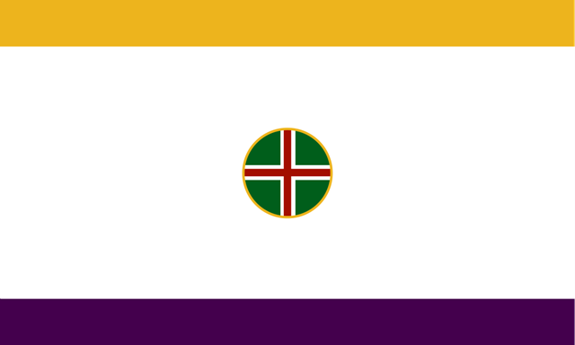
| colspan="2" align="center" | [[Image:Drapeau Oakdale.png|320px]] | | colspan="2" align="center" | [[Image:Drapeau Oakdale.png|320px]]<br>''Drapeau d'Oakdale'' | ||
|- | |- | ||
! colspan="2" align="center" valign="middle" height="20" style="font-weight: bold; font-size: 1em; background: # | ! colspan="2" align="center" valign="middle" height="20" style="font-weight: bold; font-size: 1em; background: #EDB41D; color: #ffffff" | <font size="2">'''Administration''' | ||
|- | |- | ||
| <font color=# | | <font color=#44004D>'''Pays'''</font color> || align="center" | [[Simland]] | ||
|- | |- | ||
| <font color=# | | <font color=#44004D>'''Région'''</font color> || align="center" | '''[[Génésie]]''' ([[07]]) [[Image:Drapeau Génésie Moderne.JPG|31px]] | ||
|- | |- | ||
| <font color=# | | <font color=#44004D>'''District'''</font color> || align="center" | [[Oakland District]] | ||
|- | |- | ||
| <font color=# | | <font color=#44004D>'''Comté'''</font color> || align="center" | [[Oakdale County]] | ||
|- | |- | ||
| <font color=# | | <font color=#44004D>'''Maire'''</font color> || align="center" | [[Tomy Kentleprix]] ([[PSS (2012)|PSS]]) | ||
|- | |- | ||
! colspan="2" align="center" valign="middle" height="20" style="font-weight: bold; font-size: 1em; background: # | ! colspan="2" align="center" valign="middle" height="20" style="font-weight: bold; font-size: 1em; background: #EDB41D; color: #ffffff" | <font size="2">'''Démographie''' | ||
|- | |- | ||
| <font color=# | | <font color=#44004D>'''Langues'''</font color> || align="center" | <small>Anglais ''(92%)'', Espagnol ''(7%)'', Français ''(1%)''</small> | ||
|- | |- | ||
|<font color=# | |<font color=#44004D>'''Population'''</font color> || align="center" | 4.754.125 (agglo) / 506.704 (ville) | ||
|- | |- | ||
|<font color=# | |<font color=#44004D>'''Gentilé'''</font color>|| align="center" | ''Daléen, Daléenne'' | ||
|- | |- | ||
|<font color=# | |<font color=#44004D>'''IDH'''</font color>|| align="center" | 0,925 (très élevé) | ||
|- | |- | ||
! colspan="2" align="center" valign="middle" height="20" style="font-weight: bold; font-size: 1em; background: # | ! colspan="2" align="center" valign="middle" height="20" style="font-weight: bold; font-size: 1em; background: #EDB41D; color: #ffffff" | <font size="2">'''Géographie''' | ||
|- | |- | ||
|<font color=# | |<font color=#44004D>'''Coordonées'''</font color>|| align="center" | 51°44'33,90" Nord<br>178°27'57.48" Ouest | ||
|- | |- | ||
|<font color=# | |<font color=#44004D>'''Superficie'''</font color>|| align="center" | 14 400 000 ha / 14 400 km² | ||
|- | |- | ||
|<font color=# | |<font color=#44004D><small>'''Eau /Superficie'''</small></font color>|| align="center" | 63,7 % (soit 9 172 km²) | ||
|- | |- | ||
|<font color=# | |<font color=#44004D>'''Fuseau Horaire'''</font color>|| align="center" | UTC - 12 | ||
|- | |- | ||
! colspan="2" align="center" valign="middle" height="20" style="font-weight: bold; font-size: 1em; background: # | ! colspan="2" align="center" valign="middle" height="20" style="font-weight: bold; font-size: 1em; background: #EDB41D; color: #ffffff" | <font size="2">'''Divers''' | ||
|- | |- | ||
|<font color=# | |<font color=#44004D>'''Fondation'''</font color>|| align="center" | Juin 1674 | ||
|- | |- | ||
|<font color=# | |<font color=#44004D>'''Surnom'''</font color>|| align="center" | ''Bayou City'' / ''The City of the Bayou'' | ||
|- | |- | ||
! colspan="2" align="center" valign="middle" height="20" style="font-weight: bold; font-size: 1em; background: # | ! colspan="2" align="center" valign="middle" height="20" style="font-weight: bold; font-size: 1em; background: #EDB41D; color: #ffffff" | <font size="2">'''Localisation''' | ||
|- | |- | ||
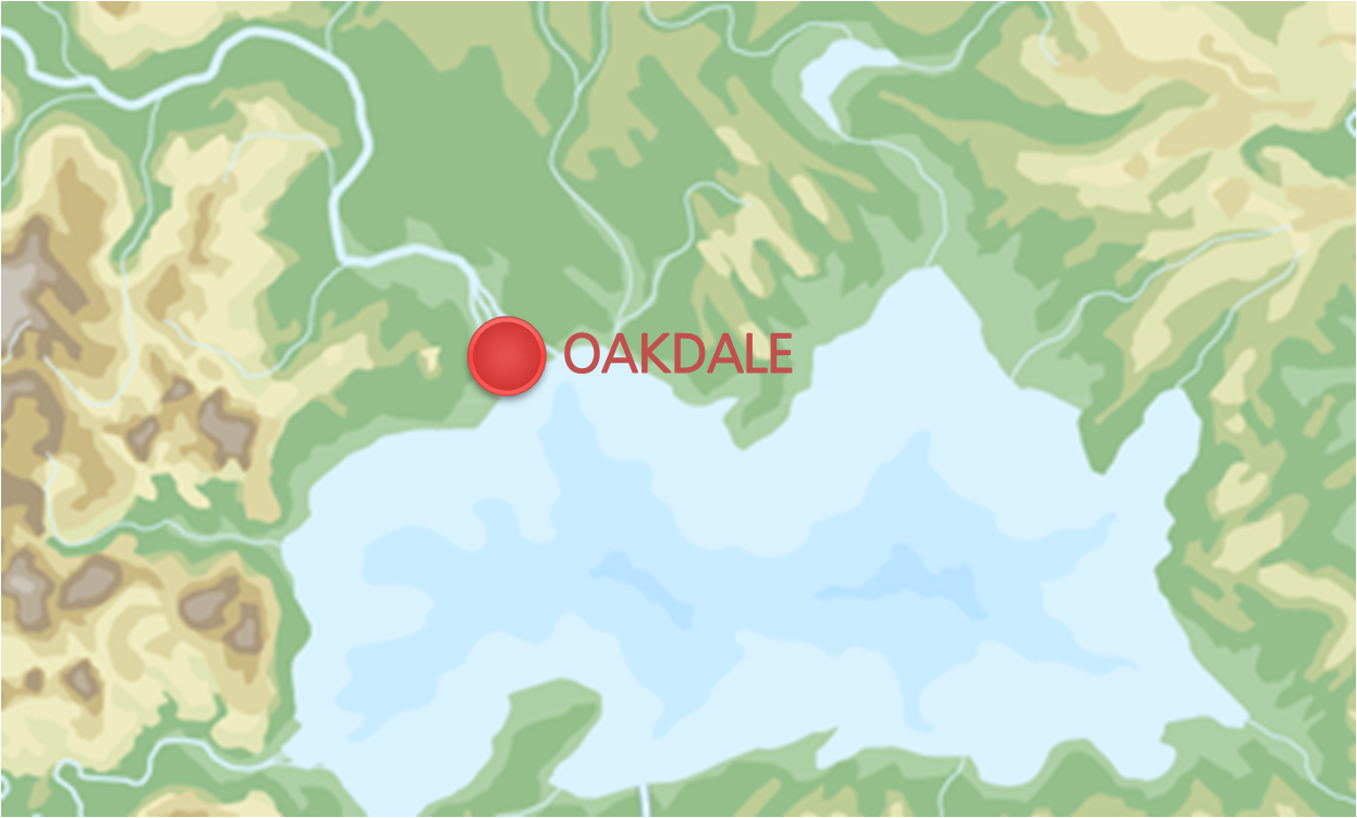
| colspan="2" align="center" |[[Image:Nouvelemplacementoakdale.png|320px]] | | colspan="2" align="center" |[[Image:Nouvelemplacementoakdale.png|320px]] | ||
Version du 12 avril 2013 à 01:06
| Ville de Simland Oakdale | |
|---|---|
 Drapeau d'Oakdale | |
| Administration | |
| Pays | Simland |
| Région | Génésie (07) |
| District | Oakland District |
| Comté | Oakdale County |
| Maire | Tomy Kentleprix (PSS) |
| Démographie | |
| Langues | Anglais (92%), Espagnol (7%), Français (1%) |
| Population | 4.754.125 (agglo) / 506.704 (ville) |
| Gentilé | Daléen, Daléenne |
| IDH | 0,925 (très élevé) |
| Géographie | |
| Coordonées | 51°44'33,90" Nord 178°27'57.48" Ouest |
| Superficie | 14 400 000 ha / 14 400 km² |
| Eau /Superficie | 63,7 % (soit 9 172 km²) |
| Fuseau Horaire | UTC - 12 |
| Divers | |
| Fondation | Juin 1674 |
| Surnom | Bayou City / The City of the Bayou |
| Localisation | |

| |
Oakdale est la capitale de la Génésie et de Génésie. C'est une agglomération de 4 754 125 habitants, et son maire est Tomy Kentleprix (PSS), depuis le 16 juin 2012.
Histoire
Dalea, Capitale des Grands lacs Espagnols (1674-1803)
Oakdale a été fondée en 1674 par les Espagnols sous le nom de Dalea, qui fondent par la même occasion leur colonie des Grands Lacs. Les terres appartenaient aux indiens Cayucos. L'emplacement qu'ils choisissent est au milieu de la Forêt d'Hanovrie qui apporte le bois nécessaire au chauffage des habitants en hiver, sur la route du nord, qu'ils comptent bien coloniser, sur une bande de sable à l'embouchure de l'Hanovria. La ville est également située sur le Grand Lac Salé, apportant à la ville la nourriture dont elle a besoin pour nourrir ses habitants, et sur un sol calcaire, un sol facile à manier pour la construction de la ville.
Oakdale, ville britannique de seconde zone (1803-1939)
Dès la fin du XVIIIème siècle les britanniques commencent à rogner les possessions espagnoles, commençant au Grand Sud, puis dans les Grands Lacs, s'étendant de plus en plus au sud-est. Dalea tombe en 1803, la capitale des Grands Lacs devient Los Antares. La ville devient britannique, et perd toute son importance politique au profit de Nanville, ville voisine fondée à quelques kilomètres de là, Nanville qui sera la capitale de la colonie de la Méridonie Britannique jusqu'à la fondation du protectorat de Midson en 1876. Durant cette période les espagnols deviennent minoritaires et quittent progressivement la ville, qui devient essentiellement britannique. Le passage au protectorat de Midson ne changera pas grand-chose dans l'organisation de la ville, qui restera de second plan jusqu'à l'arrivée des troupes méridionales et japonaises en 1939.
De la seconde guerre mondiale à la Génésie indépendante (1939-1956)
La seconde guerre mondiale a totalement chamboulé la ville. Très vite, le protectorat britannique de Midson est occupé, Oakdale sera la capitale d'occupation des japonais. Ils y construisent un aéroport militaire et y agrandissent les infrastructures portuaires, construisant un canal Lac Midson - Grand Lac Salé. Ce canal sera détruit cinq ans plus tard avec la libération. Oakdale restera une poche d'occupation jusqu'à la capitulation méridionale et japonaise, ce qui l'exposera à des bombardements alliés incessants. La ville sortira entièrement détruite de la guerre, et va devoir se reconstruire. Elle sera à nouveau endommagée fortement pendant les Evènements de Fijevas, qui vont mener à l'indépendance de la Génésie.
Le développement fulgurant de la ville (depuis 1956)
A l'indépendance de la Génésie, une bataille judiciaire oppose les daléens aux nanvillois pour savoir laquelle des deux villes doit devenir la capitale de la Hanovrie (NB: Nanville avait alors 19 000 habitants et Oakdale 13 500). A la surprise générale c'est Oakdale qui est désignée par le Président de Génésie Daniel Leprince pour être la capitale du district. La ville profite alors amplement de ce rôle pour s'étendre de façon considérable, dépassant de loin sa ville rivale. Les maires successifs ont contribué à son développement considérable, que ce soit avec l'aménagement des îles de la baie, avec la construction du périphérique, ou avec le développement des terre-plein sur la baie. En 55 ans, Oakdale est passée de 13 500 à plus de 500 000 habitants. En 1990, Oakdale commence à désigner également l'agglomération d'Oakdale, avec toutes les villes de l'actuel Oakland District, dont Nauville, Mancoba, et Keyfalls. L'Oakland District est créé en janvier 2013 avec les 4 comtés de l'agglomération d'Oakdale, transférant la capitale de la Hanovrie à Fijevas.
Géographie
Site
L'agglomération couvre une superficie de 14400 km2, dont 48,45 % en plans d'eau et 24,22% en marécages. Oakdale est située dans le delta de l'Hanovria, d'où son surnom, "The City of the Bayou" (la ville du bayou). La plus grande partie de son territoire est située en dessous du niveau de la mer (environ 60 cm). Certaines zones se trouvant déjà à 5 m au-dessous du niveau de la mer continuent à s'enfoncer en moyenne de 6 mm et jusqu'à 2,5 cm par an dans certains quartiers. Les barrages et les digues construits pour dompter les crues de l'Hanovria et faciliter le trafic fluvial ayant privé le delta des dépôts de sédiments et d'alluvions, les zones humides qui protégeaient la ville des eaux déchaînées se retrouvent aujourd'hui sous les eaux du Grand Lac Salé.
Climat
Oakdale est soumise à un climat tempéré humide beaucoup plus chaud que dans le reste de la Génésie (ce qu'on surnomme le "Microclimat du Bayou", caractérisé par des hivers froids et peu humides. Les printemps, bien que peu humides, sont les saisons des crues, qui ont rompu à plusieurs reprises les digues. Chaque printemps en effet, les fontes de neige dans les Rocheuses Simlandaises. L'été, les températures sont assez élevées, le climat plutôt très humide, et des périodes orageuses se font souvent ressentir en fin de journée, ce qui laisse au touristes des matins et des débuts d'après midi très ensoleillés. Les étés sont parfois très humides. Les automnes sont doux et humides. Ainsi, au cours de ses 339 années d'histoire, la ville a été dévastée 27 fois par des ouragans ou des inondations.
| Mois | Janv | Fév | Mars | Avr | Mai | Juin | Juil | Août | Sept | Oct | Nov | Déc | Année |
|---|---|---|---|---|---|---|---|---|---|---|---|---|---|
| Températures minimales moyennes (°C) | 6,7 | 8,4 | 12,3 | 16,1 | 19,7 | 22,8 | 23,8 | 23,8 | 22,1 | 16,6 | 12,3 | 8,7 | 16,1 |
| Températures maximales moyennes (°C) | 16,3 | 18,1 | 22,1 | 25,9 | 29,2 | 31,9 | 32,7 | 32,5 | 30,6 | 26,7 | 21,9 | 18,2 | 25,5 |
| Précipitations mensuelles moyennes (mm) | 123,2 | 133,4 | 120,6 | 119,9 | 114,0 | 146,0 | 170,7 | 168,7 | 144,8 | 75,4 | 109,0 | 132,1 | 1557,9 |
Démographie
Historique
Oakdale ville
- En 1824, Oakdale franchit la barre des 1000 habitants.
- Le cap des 5000 habitants est dépassé en 1920.
- Oakdale surpasse les 10 000 habitants à deux reprises : en 1938 et en 1950. En effet, le nombre d'habitants tombe à 8720 au cours de la seconde guerre mondiale.
Ethnique
D'après le recensement génésien de décembre 2012, Oakdale est composée de :
- WASP : 63%
- Autres caucasiens : 27%
- Hispaniques : 9%
- Autres : 1%
Sociologie
Oakdale est une ville située dans le PIB moyen de la Génésie. Le PIB moyen par habitant est de 2200 §imléons, soit 10 450 millions de §imléons.
