« Zotterveld » : différence entre les versions
Aucun résumé des modifications |
Aucun résumé des modifications |
||
| Ligne 1 : | Ligne 1 : | ||
{| class="toc" style="float: right; width: 23em; font-size: 95%; text-align: left; margin-left:1em; vertical-align:top;" | {| class="toc" style="float: right; width: 23em; font-size: 95%; text-align: left; margin-left:1em; vertical-align:top;" | ||
|- | |- | ||
| colspan="2" align="center" valign="middle" height="50" style="font-weight: bold; font-size: 1.5em; background: # | | colspan="2" align="center" valign="middle" height="50" style="font-weight: bold; font-size: 1.5em; background: #ddffdd; color: #000000" | <font size="4">'''Zotterveld'''<br/> <font size="3">''Sötterfeld''</font size> <font size=2>(su)</font size> | ||
|- | |||
| colspan="2" style="text-align: center; padding-top: 0.7em; padding-bottom: 0.7em;" | [[Image:Groote markt.jpg|250px]] | |||
|- | |||
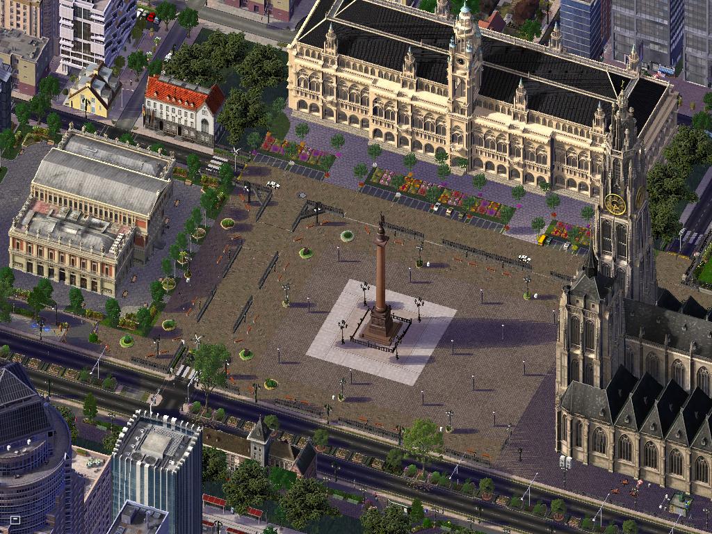
| colspan="2" align="center" |Grand Place ''(Groote Markt)'' | |||
|- | |- | ||
| colspan="2" style="text-align: center; padding-top: 0.7em; padding-bottom: 0.7em;" | | | colspan="2" style="text-align: center; padding-top: 0.7em; padding-bottom: 0.7em;" | | ||
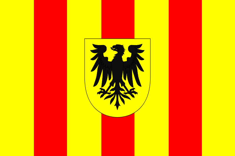
[[Image:flagzotterveld.png| | [[Image:flagzotterveld.png|125px]] [[Image:Blasonzotterveld.png|125px]] | ||
|- | |- | ||
| colspan="2" | | colspan="2" align="center" |<font size="1">Drapeau & Héraldique | ||
|- | |- | ||
| colspan="2" style="background-color: #ddffdd; text-align: center;" | '''Administration''' | |||
| colspan="2" style="background-color: # | |||
|- | |- | ||
! Pays | ! Pays | ||
| Ligne 28 : | Ligne 29 : | ||
| [[Zotterveld]] [[Image:flagzotterveld.png|22px]] | | [[Zotterveld]] [[Image:flagzotterveld.png|22px]] | ||
|- | |- | ||
| colspan="2" style="background-color: # | | colspan="2" style="background-color: #ddffdd; text-align: center;" | '''Géographie''' | ||
|- | |- | ||
! Population | ! Population | ||
| | | 1.749.980 habitants | ||
|- | |- | ||
! Superficie | ! Superficie | ||
| | | 479,39 km² | ||
|- | |- | ||
! Densité | ! Densité | ||
| 3. | | 3.650 hab/km² | ||
|- | |- | ||
| colspan="2" style="background-color: # | | colspan="2" style="background-color: #ddffdd; text-align: center;" | '''Economie''' | ||
|- | |- | ||
! Taux de chômage | ! Taux de chômage | ||
| | | 5,94% | ||
|- | |- | ||
! Revenu annuel moyen | ! Revenu annuel moyen | ||
| | | 37.974 §/an | ||
|- | |- | ||
| colspan="2" style="background-color: # | | colspan="2" style="background-color: #ddffdd; text-align: center;" | '''Politique''' | ||
|- | |- | ||
! Bourgmestre | ! Bourgmestre | ||
| Ligne 56 : | Ligne 57 : | ||
|- | |- | ||
! Sièges | ! Sièges | ||
| | | 47 | ||
|- | |- | ||
! [[Image:Logonhp.png| | ! [[Image:Logonhp.png|32px]] | ||
| 19 | | {{Barre pourcentage|couleur-bande=#FFDC00|couleur-texte=#000000|pourcentage=40|ratio-1=19|ratio-2=45}} | ||
|- | |- | ||
! [[Image: | ! [[Image:Logoprl.png|32px]] | ||
| 9 | | {{Barre pourcentage|couleur-bande=#77B5FE|couleur-texte=#000000|pourcentage=20|ratio-1=9|ratio-2=45}} | ||
|- | |- | ||
! [[Image:MDC.png| | ! [[Image:MDC.png|32px]] | ||
| 7 | | {{Barre pourcentage|couleur-bande=#FF7F00|couleur-texte=#000000|pourcentage=15|ratio-1=7|ratio-2=45}} | ||
|- | |- | ||
! [[Image: | ! [[Image:LogoGREEN.png|32px]] | ||
| 6 | | {{Barre pourcentage|couleur-bande=#7FFF00|couleur-texte=#000000|pourcentage=13|ratio-1=6|ratio-2=45}} | ||
|- | |- | ||
! [[Image: | ! [[Image:Labour.JPG|22px]] | ||
| 4 | | {{Barre pourcentage|couleur-bande=#FF0000|couleur-texte=#000000|pourcentage=8|ratio-1=4|ratio-2=45}} | ||
|- | |- | ||
! | ! [[Image:Pcn.jpg|32px]] | ||
| 2 | | {{Barre pourcentage|couleur-bande=#000000|couleur-texte=#FFFFFF|pourcentage=4|ratio-1=2|ratio-2=45}} | ||
|- | |- | ||
| colspan="2" style="background-color: # | | colspan="2" style="background-color: #ddffdd; text-align: center;" | '''Population Aire Urbaine''' | ||
|- | |- | ||
! Zotterveld | ! Zotterveld | ||
| | | 623.796 habitants | ||
|- | |- | ||
! [[Ostenbergh]] | ! [[Ostenbergh]] | ||
| | | 472.834 habitants | ||
|- | |- | ||
! [[Hament]] | ! [[Hament]] | ||
| | | 382.108 habitants | ||
|- | |- | ||
! [[Ettelghem]] | ! [[Ettelghem]] | ||
| | | 86.881 habitants | ||
|- | |- | ||
! [[Mooiendroomt]] | ! [[Mooiendroomt]] | ||
| | | 77.255 habitants | ||
|- | |||
! [[Wijk]] | |||
| 70.234 habitants | |||
|- | |||
! [[Zevenhuizen-Toren]] | |||
| 36.872 habitants | |||
|- | |- | ||
| colspan="2" style="background-color: # | | colspan="2" style="background-color: #ddffdd; text-align: center;" | '''Autres informations''' | ||
|- | |- | ||
! Gentilé (FR) | ! Gentilé (FR) | ||
| Ligne 99 : | Ligne 106 : | ||
|- | |- | ||
! Langue | ! Langue | ||
| Néerlandais et dialecte local | | Néerlandais, [[Houdois]] et dialecte local | ||
|- | |- | ||
! Aéroport | ! Aéroport | ||
| | | [[Aéroport International de Zotterveld Houdeland]] | ||
|- | |- | ||
! Altitude | ! Altitude | ||
| Ligne 110 : | Ligne 117 : | ||
| [http://www.simland.eu/forum/setopic_13368-.html] | | [http://www.simland.eu/forum/setopic_13368-.html] | ||
|- | |- | ||
| colspan="2" style="background-color: # | | colspan="2" style="background-color: #ddffdd; text-align: center;" | '''Labels''' | ||
|- | |- | ||
! [[Image:LabelWikiVille.jpg|50px]] | ! [[Image:LabelWikiVille.jpg|50px]] | ||
|- | |||
| colspan="2" style="background-color: #ddffdd; text-align: center;" | '''Localisation''' | |||
|- | |||
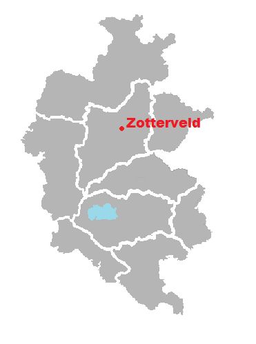
! colspan="2" align="center" |[[Image:Cartezoveld.JPG|150px]] | |||
|- | |||
|} | |} | ||
Version du 6 août 2014 à 17:32
| Zotterveld Sötterfeld (su) | |
| |
| Grand Place (Groote Markt) | |
| Drapeau & Héraldique | |
| Administration | |
| Pays | Simland |
|---|---|
| Région | Plaines de l'Avalon |
| Etat | Continental State |
| Province | Houde |
| Commune | Zotterveld |
| Géographie | |
| Population | 1.749.980 habitants |
| Superficie | 479,39 km² |
| Densité | 3.650 hab/km² |
| Economie | |
| Taux de chômage | 5,94% |
| Revenu annuel moyen | 37.974 §/an |
| Politique | |
| Bourgmestre | Charles Francis Christiaansens |
| Majorité | |
| Sièges | 47 |
19 45 | |
9 45 | |
7 45 | |
6 45 | |
4 45 | |
2 45 | |
| Population Aire Urbaine | |
| Zotterveld | 623.796 habitants |
| Ostenbergh | 472.834 habitants |
| Hament | 382.108 habitants |
| Ettelghem | 86.881 habitants |
| Mooiendroomt | 77.255 habitants |
| Wijk | 70.234 habitants |
| Zevenhuizen-Toren | 36.872 habitants |
| Autres informations | |
| Gentilé (FR) | Zotterveldois,oise |
| Langue | Néerlandais, Houdois et dialecte local |
| Aéroport | Aéroport International de Zotterveld Houdeland |
| Altitude | 380m-394m |
| Topic de la ville | [1] |
| Labels | |

| |
| Localisation | |
| |
![]() Vous lisez un article de très bonne qualité ayant été classé or par les Wiki-administrateurs
Vous lisez un article de très bonne qualité ayant été classé or par les Wiki-administrateurs
Zotterveld(en patois local Zo'veld) est une ville des Plaines de l'Avalon. Elle est aussi le Chef-Lieu du district de la Houde. C’est une ville située au bord de la Salt. Ses habitants sont appelés les Zottervelder. La ville est surtout connue pour sa cathédrale et ses remparts .
Au 1er janvier 2013, elle comptait 117.896 habitants, et une aire urbaine en comptant 311.544.
Etymologie
Zotterveld vient du néerlandais "zot" (le sot) et veld (la campagne,le champ). On pourrait donc le traduire par le champs du fou en français .
Drapeau
La ville obtient un drapeau et un blason en 1699 et son accession au statut de ville libre
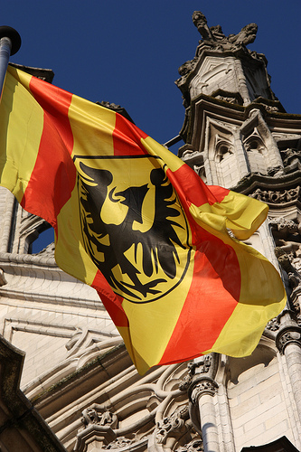
Le Drapeau de la ville de Zotterveld est le symbole officiel de la perle de la Salt, et est également le logotype de l'administration communale.
La ville utilise comme drapeau sa bannière armoriée : Un aigle noir sur fond or en écu au cœur , et à l'arrière ligné de gueules et or . Une différence est notable entre le blason et le drapeau, en effet,une couronne accompagne le blason mais est absente sur le drapeau.
Le fond jaune symbolise les champs de la campagne environnante tandis que le rouge symbolise le sang versé par les habitants pour que leur ville demeure indépendante au fil des siècles. Le petit blason intérieur représente les armoiries de Knut II, le plus grand seigneur ayant régné sur Zotterveld.
Le drapeau est également le symbole de l'ordre des métiers zotterveldois , compagnie d'artisans fondée en 1711.
On peut retrouver le drapeau de la ville aux portes de la ville , sur le Markt devant la cathédrale et à l'intérieur de l'hôtel de ville ,dans le bureau du bourgmestre, aux cotés du drapeau du Continental State et du drapeau simlandais.
Les armoiries communales sont également reprises dans le logo du club de football local du KVZ Hament.
Histoire
Préhistoire
Dès l'âge de la pierre, l'homme choisit la campagne verdoyante pour se sédentariser ,et plus particulièrement la rive droite de la Salt , c'est-à-dire la parcelle du territoire de Zotterveld incluse dans l'éperon de sable situé entre la Salt et le Maalbeek. C'est à la présence des eaux qu'il faut attribuer l'établissement d’habitations humaines, des huttes en bois sur pilotis (palafittes), à cet endroit. La mise à jour de fragments de vases et de poteries attestent de l'occupation de Zotterveld à l'âge du bronze. Pour ce qui concerne l'âge du fer, on peut citer la découverte d'autres vestiges.
Antiquité
À la fin du Ier siècle de notre ère, une villa, siège d'une importante exploitation agricole, fut construite à Zotterveld sur l'emplacement du Champ de Sint-Andries. Une chaussée romaine secondaire reliait Zotterveld au reste du Continental State, la villa romaine se trouvait non loin de cette voie. À partir du IIIe siècle le déclin de l'Empire romain s’amorce, et, au milieu du Ve siècle, nos régions sont occupées par les Francs. Au VIe siècle le peuple franc établit un cimetière sur les rives de la Salt à l’emplacement des ruines de la villa romaine. Les Francs avaient, selon leurs usages, établi leur nécropole sur les ruines des vaincus. .
Moyen-Âge
Le nom de Zotterveld est cité, pour la première fois, dans un acte de 1047. À l'époque, quatre villages occupent en fait le territoire de l'actuelle commune : Zotterveld, Ostenbergh, Mooiendroomt et Ettelghem. Zotterveld était le siège d’un chapitre de 18chanoines, dont l’origine remonte au XIe siècle, leur abbaye se trouvait pratiquement au centre géographique de la ville. Cette communauté devint bientôt le noyau d’un centre culturel qui brillera, principalement aux XVe et XVIe siècles d’un vif éclat sur le Simland de l'époque. Ce fut probablement vers le milieu du XIe siècle que s’établit la seigneurie foncière sur les bords de la Salt, le seigneur Knut II décida de bâtir un château entouré de murailles pour se prémunir contre les attaques des sarrasins et des voleurs de grands chemins. C'est à cette époque que l’église romane de Saint-Mathieu (qui est aussi le Saint-patron de la cité)sera agrandie - élevée au-dessus de la crypte - pour devenir la cathédrale Saint-Mathieu ou appelée communément cathédrale de Zotterveld dans le style gothique brabançon. Au XVIe siècle, la ville devint le repère des humanistes Simlandais logeants dans les tavernes et les maison des chanoines locaux .
Capitale de la Houde
Le XIIe siècle représente une période décisive, lorsque Knut Ier Vanter , le 31 mars 1356 moyennant 32 écus d'or et 3 vaches , rachète la Houde aux paysans locaux, André Ier fait de Zotterveld la capitale du nouvel état, en 1357. En effet, le comte obtient de François Van Buren et son épouse Béatrix le château de Kastelheer, son mandement et ses vicomté, sa juridiction, ses vassaux, et ses fiefs contre 240 pièces d'or. Le développement de la ville est ensuite très lié à l'ascension de la maison Vanter. Une nouvelle enceinte importante est construite à partir de 1552, sous l'impulsion du comte Jan VI Vanter. L'avènement de Jan VIII, premier duc de Houde en 1416, fait de Zotterveld la capitale d'un état souverain, libéré de la domination Néerlandaise. Une nouvelle noblesse zotterveldoise apparaît, liée aux institutions prestigieuses que compte la ville, et s'établit dans de belles maisons particulières. Avec ses institutions, la ville conservera néanmoins une vocation administrative ,maintenant une population importante de familles nobles. La période baroque voit s'édifier d'importants hôtels .La Houde est absorbée en 1794 par le Continental State et en 2011 par les plaines de l'Avalon.
Temps Modernes
La ville fut attaquée de nombreuses fois au XVIIe siècle mais son territoire n'a jamais été pris .En 1699 , la ville obtient le statut de ville Libre et de se fait ne fut plus jamais attaquée . Cette relative autonomie permit à la ville de se développer à une grande vitesse car elle était (et est toujours d'ailleurs) considérée comme un paradis fiscal et donc exonérée de taxes. En 1786, la ville annexe Ostenbergh et Hament dans le cadre de la "Zotterveldse Draag".La ville n'eut donc aucun mal à mettre en marche la révolution industrielle au XVIIIe siècle , elle se manifesta par la construction d'usines au bord de la Salt et à la destruction partielle de la muraille médiévale.
Époque Contemporaine
La ville fut relativement épargnée pendant les 2 conflits mondiaux même si , celle-ci dû envoyer une dizaine d'hommes au combat sur une base volontaire.La population triple, passant de 24.550 en 1900 à 73.914 en 2000. La ville devient une cité cosmopolite et le centre d'une aire métropolitaine de plus 100.000 de personnes.En 1957, la rivière Salt, traversant la ville sort de son lit : elle fera 3 victimes et beaucoup de dégâts matériels,ce qui motivera de grands travaux d'aménagement dans les années ultérieures ; l'espace résultant redevient disponible pour l'urbanisation.En 1967, Frank Meeusens dessine le projet de contournement du centre-ville de Zotterveld, jusqu'au périmètre de l'ancienne enceinte médiévale (Ring). En 1974, l'autorité communale décide de la construction d'un aérodrome sur l'emplacement d'un immense champ à Mooiendroomt,le même , qui 40 ans plus tard s'est considérablement développé grâce aux apports de contrats financiers et de développement avec de grandes entreprises.En 2001, la construction du métro de Zotterveld est avortée car le réseau de transport en commun est suffisant pour une ville de 80.000 habitants En 2003, est créée la Banque de Zotterveld (Bank van Zotterveld), celle-ci s'occupe des finances de la majorité des habitants.En 2011, on célèbre la 200ème édition du Karnavaal van Zo'veld (Carnaval de Zotterveld).
Géographie
Topographie
Zotterve se situe dans la vallée de la Salt, marquée par quelques buttes en centre-ville et dans les communes avoisinantes. Les quartiers à l’ouest de la ville sont situés en hauteur par rapport au centre-ville. Zotterveld est dominée par le mont Saint-Mathieu qui culmine à 394 mètres au nord-ouest de l’agglomération, hors du territoire de la commune.
Hydrographie
Zotterveld se situe dans le bassin versant de l’Oulatar, plus précisément à proximité de la confluence de l’Oulatar, venant du sud-ouest et de la Salt qui irrigue la ville. La Salt va je jeter dans le fleuve Oulatar à Verbenden. Les rives de la Salt font partie intégrante de la ville historique ,c’est la que c’est développé un petit port de plaisance et un petit port de marchandise. Au sein de la ville coulent également plusieurs ruisseaux.
Structure communale
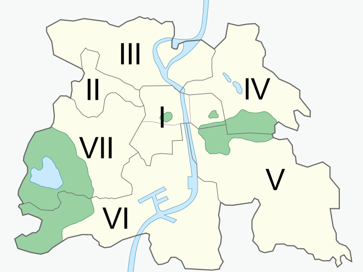
| Lieu | Population |
|---|---|
| Zotterveld | 117.896 |
| Ostenbergh | 82.478 |
| Hament | 56.876 |
| Ettelghem | 31.845 |
| Mooiendroomt | 22.449 |
- Zotterveld est le "chef-lieu" de l'entité Zotterveldoise , elle comprend les quartiers aisés, le cœur médiéval et vie culturelle
- Hament est un village annexé en 1786 , elle comprend notamment le stade du KVZ Hament et des lotissements
- Ettelghem est la commune située au Sud de Zotterveld , de nombreuses entreprises s'y sont installées
- Ostenbergh est la commune située de l'autre côté de la Salt , elle comprends notamment le centre logistique communal et l'église Sint-Maarten
- Mooiendroomt est un lieu dit qui comprend l’aérodrome de Zotterveld et une zone industrielle lourde
Communes limitrophes

|
Mooiendroomt | Wijk | Hament | 
|
| Ostenbergh | Nord | Hament | ||
| Ouest Zotterveld Est | ||||
| Sud | ||||
| Ostenbergh | Zevenhuizen-Toren | Ettelghem |
Climat
Zotterveld est située dans la zone tempérée nord et est soumise à un climat continental avec quatre saisons distinctes. Il y fait souvent venteux avec des variations marquées entre un été chaud et un hiver froid et humide. La ville est l'une des plus chaudes et sèches du Simland. Ces dernières années, les transitions entre l'hiver et l'été et entre l'été et l'hiver semblent avoir été plus rapides. Les épisodes neigeux sont moins fréquents que dans le passé.
Démographie
Population
En 2013, la ville de Zotterveld comptait 117.896 habitants dont 4,4 % d’étrangers
| 1800 | 1810 | 1830 | 1850 | 1870 | 1890 |
|---|---|---|---|---|---|
| 6.500 | 7.000 | 11.000 | 14.600 | 20.000 | 29.000 |
| 1910 | 1930 | 1950 | 1970 | 1990 | 2010 |
| 30.400 | 39.700 | 57.500 | 68.000 | 79.000 | 112.000 |
Religion
| Religion | Population |
|---|---|
| Catholique romains | 82.860 |
| Protestants | 29.547 |
| Communautés islamiques | 2.071 |
| Chrétiens-orthodoxes | 1.748 |
| Communauté de confession juive | 958 |
| Aucune appartenance | 712 |
| Total | 117.896 |
Langue
La langue officielle de la ville est le néerlandais.
Le tableau suivant détaille la langue principale des habitants en 2013 :
- La langue houdoise est assimilée au néerlandais dans ce recensement. Il est à notter qu'une très grande majorité des habitants la conaissent.
Politique
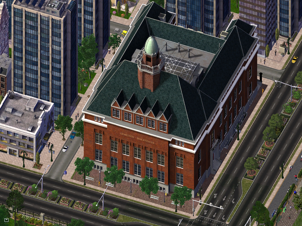
En tant que chef-lieu de la province de la Houde, Zotterveld acceuille les bureaux du Parlement houdois qui font office à la fois de parlement et de conseil général. La ville est également le siège de nombreuses institutions houdoises, notamment la résidence du Chancelier Houdois et de son administration. Ces bâtiments sont concentrés autour de la Wetstraat (rue de la Loi), la rue la plus encombrée au niveau du trafic de toute la ville.
Communauté urbaine
La communauté urbaine exerce de nombreuses compétences en lien avec les services à la population comme la gestion de l'eau, des déchets, des transports, le sport ou encore de la voirie et intervient également sur les grands projets de territoire tels que le développement économique, l'aménagement urbain ou l'enseignement supérieur.
La communauté urbaine de Zotterveld regroupe 11 communes :
| Code postal | Ville | Maire | Parti | Population | Superficie | |
|---|---|---|---|---|---|---|
| 02247 | Afsene | Adriana Hoogendoorn | Parti National Houdois |
2.797 | 10,15 km² | |
| 02248 | Beselaere | Tim Verhoek | Mouvement Démocrate Centriste |
6.911 | 38,49 km² | |
| 02249 | Bovekerke | Kees Gebben | Mouvement Démocrate Centriste |
4.666 | 18,57 km² | |
| 02250 | Gottem | Jan-Hendrik Kerstvagen | Union Démocrate Libérale |
8.141 | 15,46 km² | |
| 02251 | Grote-Brogel | Erik van Ostenhout | Sans Étiquette | 2.588 | 19,14 km² | |
| 02252 | Kleine-Brogel | Bert Burenmeester | Parti National Houdois |
1.167 | 12,03 km² | |
| 02253 | Leefdal | Jacques Trickaart | Parti National Houdois |
17.874 | 16,36 km² | |
| 02254 | Proven | Rita Berlaere | Parti National Houdois |
6.794 | 15,94 km² | |
| 02255 | Saltmonnikoog | Martine Steenkamp | Union Démocrate Libérale |
11.876 | 54,82 km² | |
| 02256 | 't Haantje | Marieke Waaren | Parti Socialiste Avalonien |
7.701 | 7,23 km² | |
| 02240-02246 | Zotterveld | Charles Francis Christiaansens | Parti National Houdois |
339.011 | 130,20 km² | |
| Totaux | 409.526 habitants | 331,16 km² | ||||
Administration
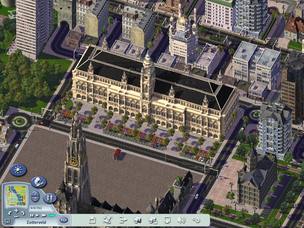
La ville de Zotterveld est administrée depuis 1874 par un collège échevinal qui, à l'époque, représentait et défendait les interêts des différents corps de métier présents dans le ville. De nos jours , les échevins sont élus au suffrage universel direct. Ensuite, ils forment une majorité et élisent un bourgmestre (maire) pour une durée de 5 ans.Charles Francis Cristiaansens II est le bourgmestre de la ville depuis les élections communales de 2002. Les prochaines élections ont lieu tout les 5 ans (hors cas d'élections anticipées).
Liste des Bourgmestres
| Nom | Dates du mandat | Parti | Notes | |
|---|---|---|---|---|
| Rudy Desmedt | 1874-1879 | |||
| Albert Maesens | 1879-1889 | |||
| Hugues LeFlot | 1889-1894 | |||
| Jan De Baeremeester | 1894-1914 | Il resta 20 ans au pouvoir. | ||
| Bert Maag | 1914-1918 | Est décédé pendant son mandat. | ||
| Kurt Van Portenboog | 1918-1923 | Premier bourgmestre élu avec une formation politique. | ||
| Alfons Jeurissen | 1923-1933 | |||
| Dirk Jeurissen | 1933-1943 | Fils de Alfons. | ||
| Martin Vermeersch | 1943-1963 | |||
| Jan Frulders | 1963-1968 | |||
| Tomas Verbolder | 1968-1972 | |||
| Huub Bourgeois | 1972-1982 | |||
| Charles Francis Cristiaansens Ier | 1982-2002 | |||
| Charles Francis Cristiaansens II | 2002-Aujourd'hui | Fils du précité. | ||
Résultat des élections
Majorités
Activité économique
L'activité économique et les loisirs se sont significativement développés ces dernières années, en raison d'une amélioration des infrastructures. Zotterveld, en tant que ville centrale dans le CS, est devenue un point clé où transitent de plus en plus de biens et de personnes, avec des liaisons routières et férovières régulières avec Luisbourbonburg Am Avalon ,Oulatar,Vlieland et Brenta . Le trafic aérien a doublé entre 1993 et 2004, grâce à la modernisation de l'Aérodrôme de Mooiendroomt.
Quelques institutions financières sont localisées à Zotterveld, à l'instar de la BVZ (Bank van Zotterveld). Les échanges commerciaux à travers Zotterveld sont en augmentation ces dernières années,grâce à sa position centrale dans le CS. Zotterveld génère une production industrielle moyenne et met l'accent sur les services publics, le secteur financier, l'agro-alimentaire, le textile et l'édition de livres.
Économie générale
Zotterveld est le siège de la Bank van Zotterveld. Grâce à son emplacement géographique, Zotterveld a toujours été un lieu de passage pour les biens et les personnes. Au centre du Continental State, la ville se situe au carrefour d’un axe nord-sud historiquement très utilisé et d’un axe est-ouest légèrement moins utilisé mais tout de même important. Son emplacement sur la Salt favorise les échanges par voie fluviale. Comme dans la plupart des ville, le secteur d’activité prédominant est le secteur tertiaire, bien que l’industrie représente encore une part non négligeable des emplois, notamment dans la sidérurgie. Le taux de chômage à Zotterveld est, contrairement à beaucoup de grandes villes du Simland, inférieur à la moyenne nationale. Mais cela n'a pas toujours été le cas. Pendant longtemps, la ville s'est distinguée par un taux de chômage remarquablement faible, bien aidée par un secteur secondaire dynamique. Cependant, le recul des activités industrielles au CS a progressivement réduit l'écart entre les chiffres flatteurs de la ville et le reste du pays .
Évolution du taux de chômage
| Année | 2002 | 2003 | 2004 | 2005 | 2006 | 2007 | 2008 | 2009 | 2010 | 2011 | 2012 |
|---|---|---|---|---|---|---|---|---|---|---|---|
| Taux de chômage à Zotterveld | 4,5 % | 3,3 % | 3,2 % | 3,8 % | 4,7 % | 5,4 % | 5,8 % | 6,0 % | 5,0 % | 4,7 % | 5,0 % |
Secteur primaire
Le secteur primaire de Zotterveld représente 6% de l’activité économique de la ville.Il est caractérisé par la culture du malt, de l’orge et de la betterave sucrière dans de grands champs de la région zotterveldoise .
Secteur secondaire
Les activités industrielles à Zotterveld ont pour particularité d'être peu diversifiées. Elles représentent 19 % des emplois. Sur les 700 entreprises industrielles, plus de 30 % sont à capitaux étrangers, notamment russes et américains. Les trois principaux secteurs sont la sidérurgie (forges,aciéries) ,l’industrie automobile (fabrication de pistons) et l’agroalimentaire (brasseries et chocolateries).
Le petit port sur la Salt à facilité de transport des marchandises malgré sa taille réduite et à joué un rôle important dans le développement économique de la ville. Avec 21.000 tonnes de marchandises en trafic fluvial, il n’est malheureusement pas assez développé pour concurrencer les grands ports intérieurs nationaux. Il reste de gros groupes qui produisent de l’acier dans la région proche de la ville; les autres sont gérées par de petits indépendants ,ce qui rend la région très attractives mais surtout très rentables, embauchant alors beaucoup de travailleurs.
Secteur tertiaire
Commerce
L'activité commerciale représente plus de 75% des emplois à Zotterveld. Deux zones commerciales concentrent l'essentiel de l’activité : le centre-ville rassemble des boutiques de vêtement, des magasins divers ainsi que des magasins d’alimentation. Le quartier de la Gare abrite également de nombreuses boutiques, des orfèvres ainsi que des bijoutiers de luxe et de grandes enseignes de mode. La ville à également investit dans la rénovation et l’agrandissement de l’aérodrome de Mooiendroomt, ce qui a permit au commerce de se diversifier et d’améliorer le transit dans toute la région.
Finance
Zotterveld est une petite place financière et bancaire du Simland et jouit d'une spécificité importante dans ce domaine, elle est le siège de la banque éponyme BVZ. Les activités financières emploient plus de 3.000 personnes sur Zotterveld, secteur immobilier inclus.
Tourisme
Le tourisme est une activité importante pour Zotterveld. Le secteur y emploie près de 10.000 personnes dans la région. Chaque année, le célèbre Karnavaal van Zo’veld (ou Carnaval de Zotterveld), draine un nombre considérable de visiteurs, les capacités hôtelières de la ville et de toute la région faisant le plein à cette période. La ville peut aussi se targuer d’avoir conservé un patrimoine architectural exceptionel par sa cathédrale, ses remparts, ses rues étroites,ses musées ainsi que son patrimoine religieux exceptionnel.
Restauration
La restauration est très développée à Zotterveld, notamment dans le centre-ville. Tous les types de restaurants sont représentés, depuis les très nombreuses friteries (que l’on doit aux ancêtres belges des habitants) ,jusqu’aux restaurants trois étoiles, en passant par la restauration régionale typique.
Transport
Voies routières
L’agglomération de Zotterveld est desservie par une faible infrastructure autoroutière. Les voies express autour de Zotterveld permettent de faire un tour complet de la ville, la route la plus dense est le Ring ,une boucle de 2 fois 2 bandes qui permet de desservir l’hyper-centre de la ville et qui est limité à 110km/h. L’ensemble des routes et voies express qui relient la ville aux autres communes du Continental State rayonnent autour d’un anneau de grandes avenues et de boulevards qui, aménagé selon le modèle belge d’un Ring, distribue les accès depuis et vers l’hypercentre. Cette morphologie de boulevards phériphériques rend la circulation automobile particulièrement fluide, y compris aux heures de pointe.
Stationnement
En 2006, la ville de Zotterveld a entrepris un vaste plan en vue de contrer les problèmes rencontrés par les usages pour se garer .Ce plan comporte la création de parking aux abords du centre ainsi que la construction de parkings souterrains dans 3 zones (la Gare ,le musée d’Histoire naturelle et la Grondwetstraat-Ring.
Aéroports
L’aéropodrôme régional de Mooiendroomt, situé à 15 km du centre, est relié par une voie expresse à la sortie nord-ouest de la ville. Des liaisons aériennes directes existent vers de nombreuses grandes villes du Simland grâce à Air Continental.
Réseau ferroviaire
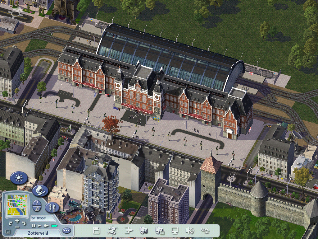
Le réseau ferré de la ville en provenance de trois directions majeures (Luisbourbonbourg,Oulatar et Vlieland), fait un tour complet de Zotterveld. Plusieurs discours politiques ont mentionné l’idée d’une ligne tram-train faisant le tour du centre-ville, en créant ou réhabilitant plusieurs gares autour du centre même. Le nœud ferroviaire principal de l'agglomération est la gare Centrale de Zotterveld. Le réseau ferré régional a été refondu récemment pour améliorer les déplacements entre Zotterveld et le reste du Simland: tarification régionale à prix réduit, 46 trains par jour allers-retours entre diverses villes du Simland. De nouvelles rames climatisées à deux niveaux ont permis de rajeunir le parc des wagons qui devenais vieillissant.
Transport fluvial
Pour le tourisme, Zotterveld est accessible par la Salt canalisée directement au centre-ville par le biais de son petit port de plaisance et sa marina situé au bord de la Salt. Zotterveld possède également un petit port de marchandise qui permet le commerce de 1500 tonnes de marchandises par an.
Transports urbains en commun
Zotterveld possède un réseau de bus géré par la ville et un consortium d’investisseurs privés. Ce réseau de se déplacer rapidement dans la ville et permet de rejoindre les villages avoisinants . De plus, de nombreuses liaisons permettent de se rendre dans la plupart des régions du Simland. Contrairement à d’autres villes d’importance similaire, la ville n’a pas développé de transport en site propre. Le parc de bus est particulièrement moderne et bien entretenu .Il tend à se fondre de plus en plus dans la circulation automobile et piétonne, aussi le maire Cfc94 prévoit la création de deux lignes performantes de tramway, suivant l’axe des remparts et une ligne nord-sud. La ville étudie actuellement un service d'autopartage.
Ancien tramway
Zotterveld a disposé d'un réseau de tramway entre 1900 et 1968. En 1968, le réseau comportait 3 lignes :
- ligne 1 : Hament-Einde – Ettelghem-Zuid.
- ligne 2 : Burg – De Komp.
- ligne 3 : Haven – Markt.
Nouveau tramway
 Article détaillé : Tramway de Zotterveld
En 2008,soit 50 ans après le passage du dernier tram à Zotterveld, la ville a décidé de reconstruire de nouvelles lignes de tram pour contrer l'afflux d'un grand nombre de véhicules dans le centre-ville et ses alentours.
3 lignes furent construites pratiquement sur le même tracé que les anciennes.
Piétons et bicyclettes
En 1995 ,une commission municipale sur le déplacement à vélo fut mise en place par la municipalité avec comme objectif de définir les choix d’investissements pour mettre en cohérence les nombreuses pistes dédiées à « la petite reine ». À cette époque, le vélo n’était encore considéré par la mairie, que sous l’angle d’un mode de déplacement de loisir malgré l’attachement des descendants des néerlandais et des belges qui vouent un véritable culte au vélo dans leur pays. Les projets de développement s’appuyaient essentiellement sur de grandes liaisons intercommunales, loin du réseau de circulation routier. Elles s’inséraient dans le vaste réseau de pistes de promenade liées aux circuits tourristiques. Ce dispositif modeste était complété par une offre de location de courte ou longue durée de vélo à proximité de la gare centrale. Les vélos sont admis dans toutes les rues et dans tous les sens de circulations,ce qui était interdit auparavant. De nombreuses zones 30 ont fait leur apparitions dans le centre ville . Une rue piétonne à été amménagée dans le quartier commerçant de la ville ,ce qui a permis de dynamiser cette artère et de créer de nombreux emplois.

Les ZO'fiets sont un système de vélos en libre-service disponible depuis 2013 à Zotterveld. Mis en place par la Mairie, pour désengorger la ville des embouteillages.
Disponible, dans un premier temps, uniquement dans l'hyper-centre de la ville, le système a été déployé, dans les autres communes de l'entité pour atteindre progressivement le chiffre d'environ 420 vélos répartis sur 27 stations. Comptant environ 4 000 abonnées à l'année. Ils ont été utilisé pour plus de 9 millions de trajets. En moyenne, environ 811 locations sont effectuées chaque jour.
Santé
Zotterveld est le premier pôle de santé de la Houde avec l'Hôpital Universitaire de Zotterveld Saint-Mathieu, installé sur le site de la Chartreuse, l'hôpital Centraal est quant à lui situé dans le centre de la ville ainsi que la maternité. L'agglomération possède de nombreuses cliniques privées.
Justice
Le tribunal de grande instance de la Houde est situé dans le Palais de Justice de Zotterveld.
Dans l'ordre administratif, Zotterveld est du ressort du tribunal pénal de Luisbourbonburg et dans le super arrondissement judiciaire des Plaines de l'Avalon basé à Saint-Louis sur Avalon.
Il ne subsiste aucune prison à Zotterveld. Les principales prisons se situant en dehors de la ville et dans d'autres provinces.
L'hygiène est gérée par le service municipal d'actions de salubrité et d'hygiène de la ville de Zotterveld.
Culture
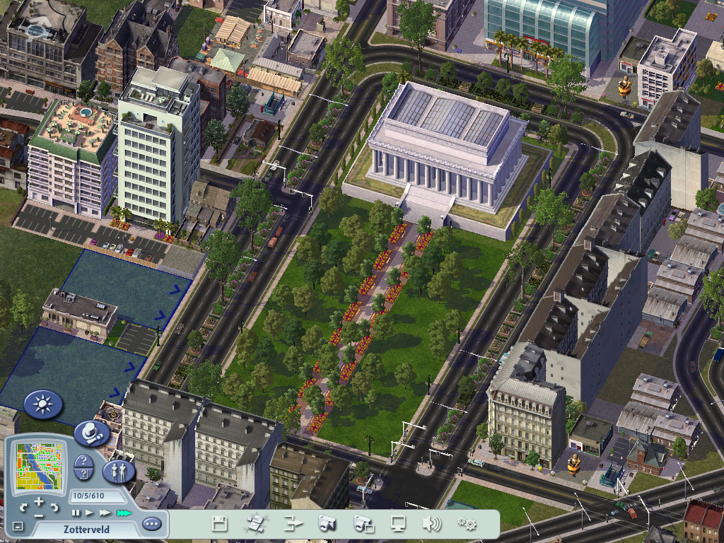
Zotterveld est le cœur culturel du CS. Du fait de son caractère historique multi-culturel , la ville comprend de nombreux théâtres, musées, galeries, salles de concert et de cinéma.
- Théâtre de Zotterveld.
- Orchestre philharmonique "de Muziekers".
- Musée de la poterie.
- Galerie d'art Moyo.
- Un musée d'Histoire naturelle, avec un million d'objets exposés, est l'un des plus riche du Simland.
- Le musée de l'Horlogerie permet, quant à lui, de découvrir une superbe collection de cadrans solaires portatifs, d'horloges et de goussets ouvragés, réalisés par les maîtres de la ville à partir du XVIIeme siècle
Enseignement
La ville de Zotterveld comprends 8 écoles maternelles , 7 écoles primaires et 3 écoles secondaires toutes ces écoles sont publiques et subventionées par le budjet de la ville. Les résultats des élèves des écoles de l'entité sont au delà de la moyenne générale simlandaise.
Un septième de la population de la ville est composée d'étudiants ce qui en fait une ville jeune. L’Université Catholique de Zotterveld, la plus importante de la Houde , fut fondée en 1857. En 2012, l’université de Zotterveld est composée de 4 facultés, de trois académies et d'un collège. Celles-ci proposent des cours dans de nombreuses matières comme l'économi, les sciences humaines, les lettres. C'est la seule université de Simland à octroyer un master en sport. La population étudiante de l'université est proche de 25.000 étudiants et le corps enseignant est fort d'environ 1.300 membres.
En 2012, la bibliothèque nationale de la Houde et la bibliothèque de l’université disposent ensemble de 1 169 090 livres.
Sport
Le sport le plus populaire à Zotterveld est le football (tant par le nombre de joueurs que par le nombre de spectateurs). La ville possède plusieurs clubs de football dont deux qui évoluent en Division 2 simlandaise ,le KVZ Hament et le VG Ostenbergh les autres clubs évoluant dans les divisions inférieures. La ville de Zotterveld a été le théâtre de la première édition de la Simland Cup en recevant plusieurs match de poule ainsi que deux quarts de finale et les 2 demi-finales .
La ville a également posté une candidature pour accueillir la Coupe du monde de rugby à XV de 2013 et dont Simland a remporté l'organisation.
Zotterveld compte également un club de rugby évoluant dans le championnat amateur (Zotterveld Rugby ).
La ville se distingue par 17 titres de champion de Simland en pétanque.
On peut également citer le TC Zotterveld , le club de tennis de la ville qui jouit d'une bonne réputation locale.
La ville à déposé une candidature à l'organisation des Jeux simlandais 2012 au même tire que les villes d'Oulatar et d'Haarburg.
Zotterveld est également la ville départ et/ou arrivée du Tour de Houde cycliste depuis 1908.
Infrastructures
 Article détaillé : De Komp
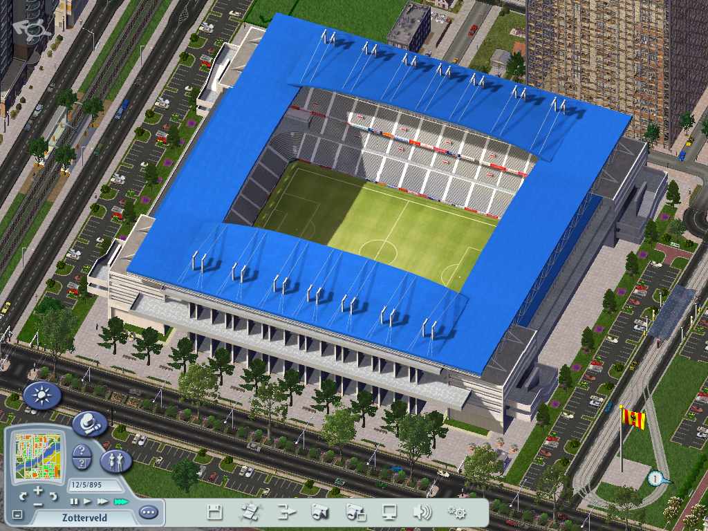
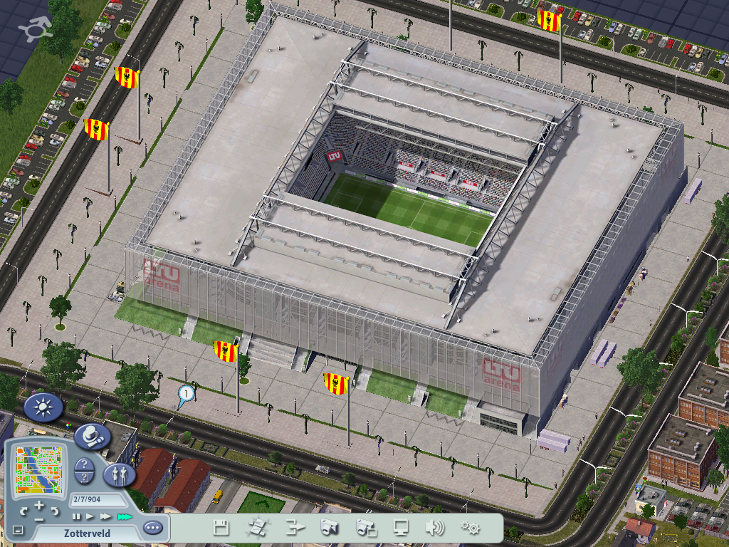
Le club du KVZH a déménagé au Nieuwe Komp Stadion, un stade flambant neuf de 52.356 places à la fin de la saison 2012 car le stade De Komp, situé dans le Nord de Zotterveld, était jugé trop vétuste et trop petit pour jouer en Division Nationale Simlandaise. Le stade ne pouvait accueillir que 15.000 spectateurs, il fut démoli en 2012 pour laisser la place à des terrains communautaires.
L'autre stade de la ville, le Stade de la Houde, avec ses 65.323 places est quant à lui un stade multisport et multifonctionnel occupé par le Zotterveld Rugby, les Houders Fottball de Zotterveld (club de football américain) et de la KAA Zotterveld (club d'athlétisme) et du VG Ostenbergh.
Le Stadelijk Sportstadion peut accueillir jusqu'à 12.000 spectateurs accueille le troisième club de la ville : le FC Zotterveld.
Une salle omnisports et une piscine olympique complètent les infrastructures de la ville
Il existe une dizaine de terrains de pétanque disséminés dans la ville.
Folklore
 Article détaillé : Carnaval de Zotterveld
L’année folklorique zotterveldoise débute au printemps avec la ducasse qui a lieu tous les ans le dimanche le plus proche du 5 avril. Cet évènement festif propose un grand marché aux fleurs pour célébrer le retour du printemps.
L’apogée folklorique de Zotterveld se nomme le Karnavaal van Zo'veld (Carnaval de Zotterveld) .Les festivités ont lieu 15 jours avant le dimanche de la Trinité et sont déjà précédées d’activités le vendredi et le samedi soir avec notamment des concerts gratuit sur le Markt et se prolonge jusqu'au mercredi suivant, avec le feu d'artifice le mardi soir et le dimanche; jour où se déroule à la parade colorée annimée par les habitants de la ville , chaque année , un thème est défini pour l'année suivante dés le lendemain de la fin des festivités. Cette manifestation folklorique a lieu depuis 200 ans.
Le 27 septembre, grâce à des comités de commerçants, la ville s’embrase avec la fête de la Saint-Mathieu.
Durant l’automne, Zotterveld accueille une grande fête foraine Elle se déroule durant le mois de novembre.
L’année festive se termine en décembre par des illuminations et surtout par son marché de Noël sur le Markt et dans ses environs qui accueille patinoire, chalets en bois et sapin de Noël.
Médias
- Le quotidien phare de Zotterveld est le Zotterveld Algemeen Dagblad (ZAD) dont le bassin de diffusion est la région de Zotterveld.Il traîte de l’actualité nationale et régionale,les sport ,et l’économie. Les autre journaux simlandais sont disponibles dans les librairies de la ville,tandis que le ZD est vendu dans des distributeurs au prix de 1§.
- Z+, est la télévision régionale du nord-est du Continental State,elle diffuse des programmes généralistes ainsi que deux journaux par jour,l’un national et international, l’autre local, elle à également le droit de suivre les matchs de football des 2 équipes de la ville en direct.Les autres chaînes de télévision simlandaises sont également disponibles.
- Z-Radio est la radio régionale qui émet dans un rayon de 190km autour de la ville.Elle diffuse un programme varié ainsi que les événements sportifs en direct et les informations régionales.Nombres d’autres radios simlandaises sont disponibles à Zotterveld.
Parc & Jardins
Zotterveld compte 63 parcs et jardins dont le Bois de Tullingen et le Bois de Wijk ainsi que trois cimetières arborés. On trouve des jardins anciens dans le cœur de la ville. Le jardin dit Muysdont a été créé au XVIe siècle, sur la rive droite de la Salt. Le jardin des Plantes à été crée par les étudiants de l'ancienne faculté de médecine pour la culture des plantes médicinales.
Depuis les années 1980, plusieurs espaces verts ont été aménagés dans des zones d'activités désaffectées. Le parc du centre est aujourd'hui le plus grand parc de Zotterveld intra-muros, il est situé dans un des angles de l'ancienne forteresse médiévale. Des jardins familiaux ou éducatifs ont également agrémenté la périphérie de la ville le long d'anciennes lignes ferroviaire.
Ambassades
 Article détaillé : Ambassade du Royaume de Belgique
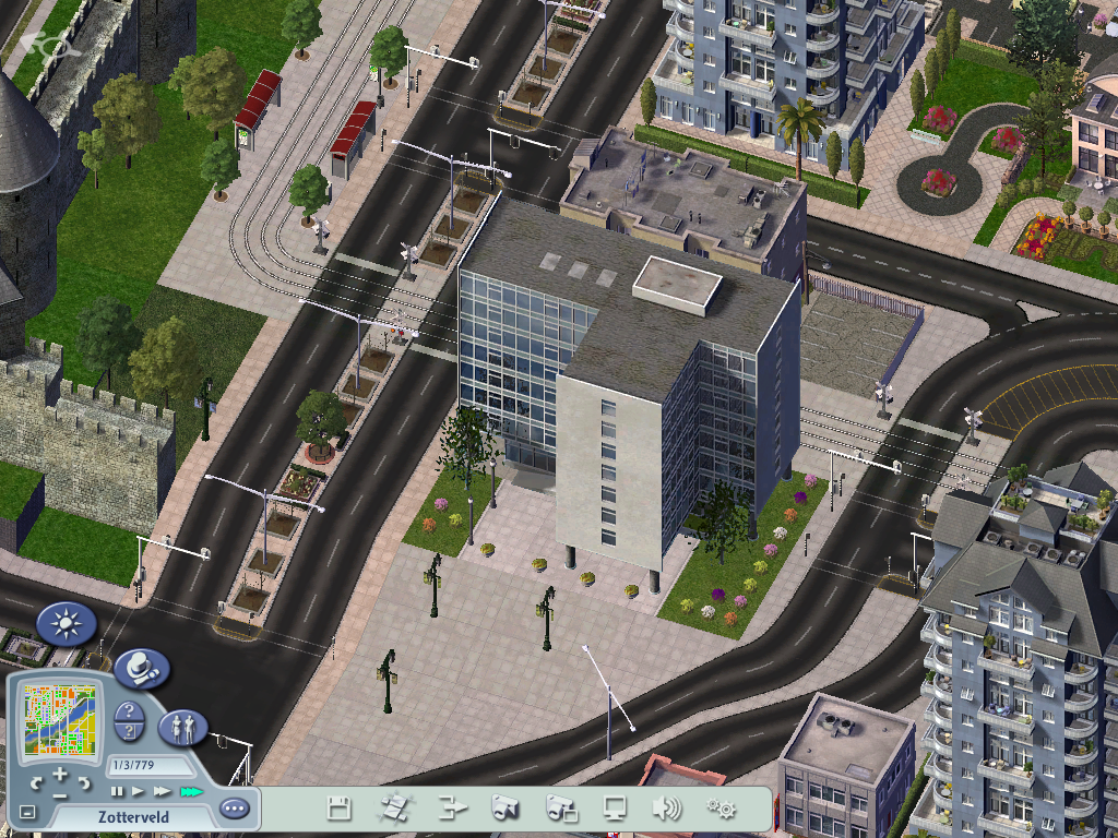
La ville accueille l'ambassade du Royaume de Belgique, de Lettonie, de Lituanie et d'Estonie.
Jumelage
La ville de Zotterveld entretient un jumelage avec :
- Mons
- Binche

- Luxembourg-ville
- Valence
- Westfield
Monuments
La ville de Zotterveld recèle de nombreux monuments et places à visiter,voici une liste non exhaustive de ceux-ci:
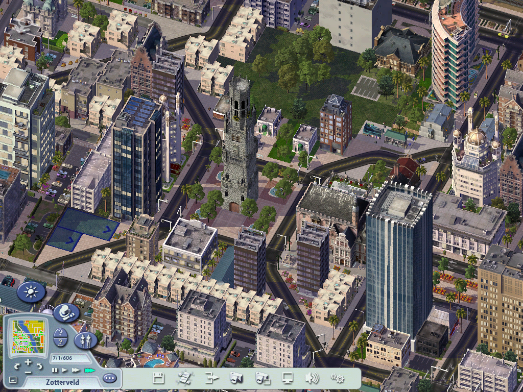
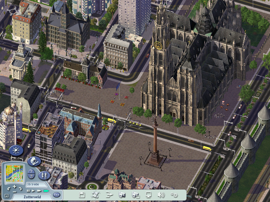
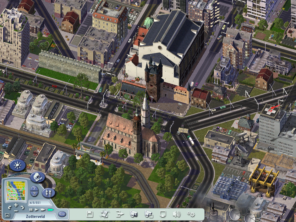
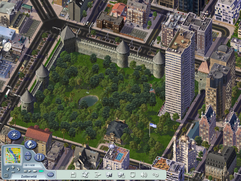
 Article détaillé : Cathédrale Saint-Mathieu
-La cathédrale Saint-Mathieu, de style gothique, principalement bâtie du XIVe siècle au XVIe siècle, a été très restaurée au début du XXe siècle et sa façade à également été nettoyée à la fin du XXe siècle. Elle est symboliquement le noyau de Zotterveld .Elle est visible à 30 kilomètres autour de la ville.
-Le beffroi est de style gothique ,il à été bâti vers 1567,il est situé dans la zone commerciale de la ville.
| Monuments et lieux touristiques | ||
| Églises | Monuments profanes principaux | Places & autres |
|---|---|---|
| Cathédrale Saint-Mathieu | Beffroi | Markt |
| Saint-Étienne | Hôtel de ville | Place Saint-Étienne |
| Chapelle Sainte-Alix | Gare centrale | Parc de la ville |
| Eglise d’Ostenbergh | Ruines du château du roi Knut II | Place de la gare |
| Section de la commune de Zotterveld | |
|---|---|
| Zotterveld • Ettelghem • Hament • Mooiendroomt • Ostenbergh • Wijk • Zevenhuizen-Toren | |
| Ville du Grand Duché des Plaines de l'Avalon | |
|---|---|
| Saint-Louis sur Avalon | Haarburg | Hilda | Kasteelheer | Aubétoile | Luisbourbonburg | Oulatar | Rotsklimmen | Zotterveld | Aurora | |

